

It’s been a while since my last Sound & Vision; a photo-essay with audio companion. Feel free to click the play button below and discover the sights and sounds of Wind Mountain in this mixed media narrative of a trip to its mysterious summit.
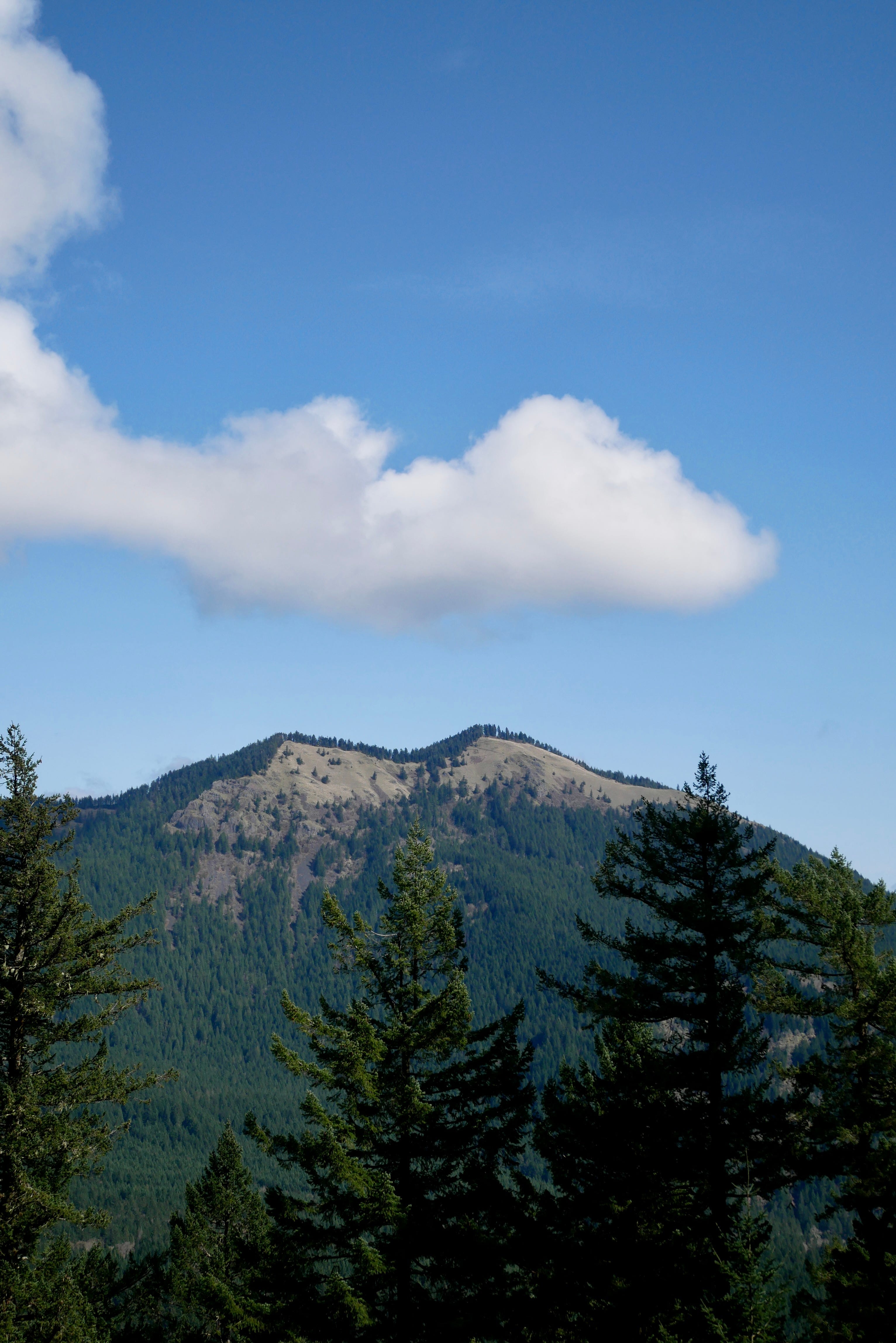
I hiked up Wind Mountain in the Columbia Gorge yesterday with my son. This is what it looks like zooming in from Near-Earth orbit:

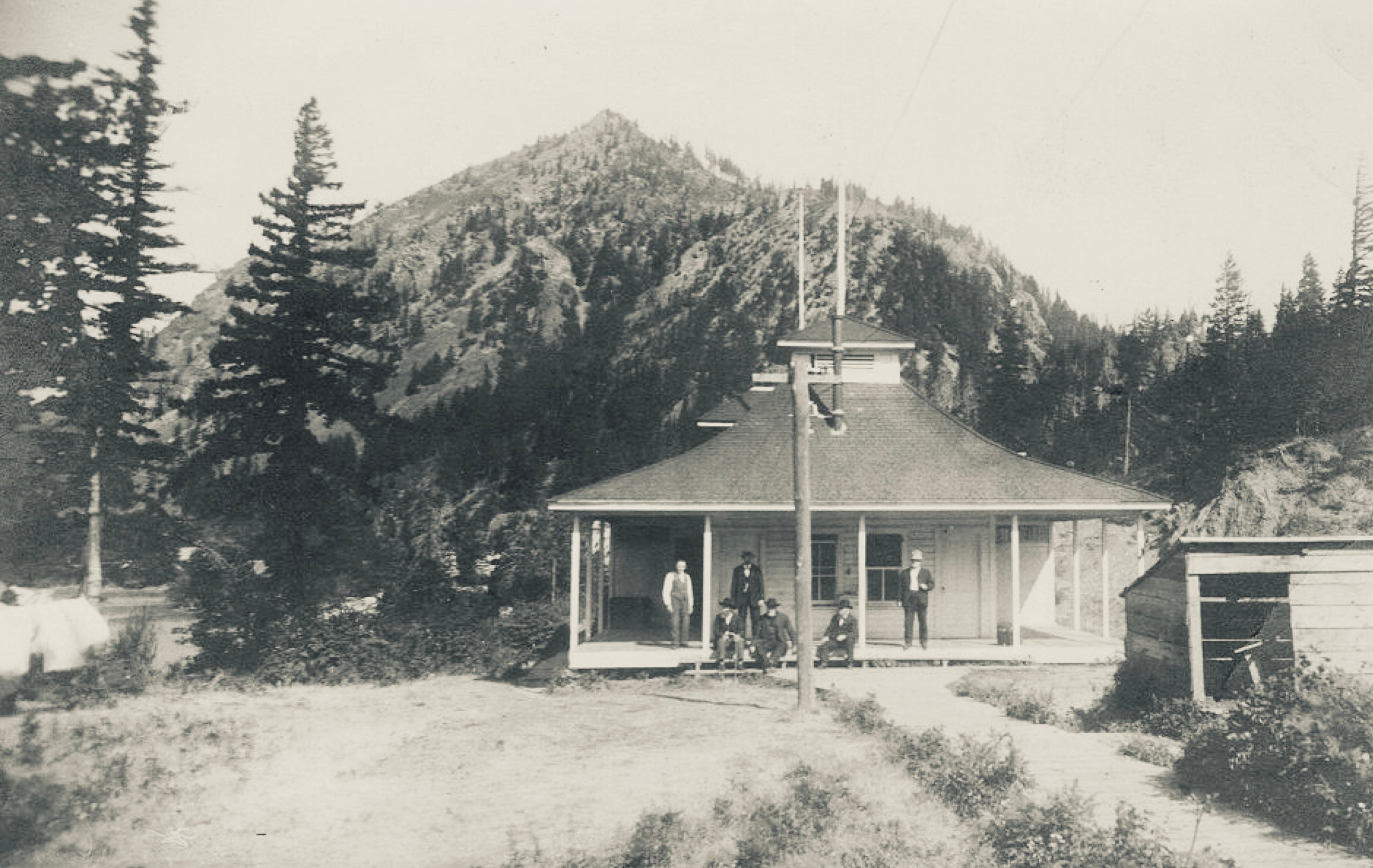
This is what it looked like in 1911, looking up from the Columbia River:
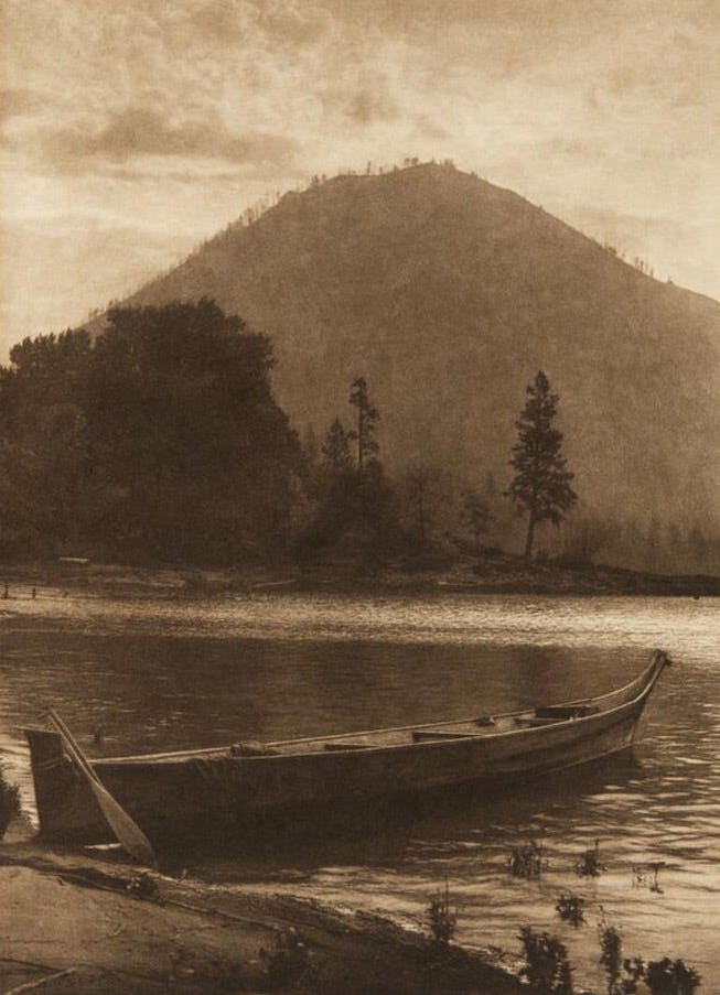
In many ways, these two images encapsulate the strange tension of this place and time we find ourselves in. GPS and satellite imagery are so familiar now that we now scarcely recall route-finding in the old ways. At any point on the hike I could look at my phone and see myself as a blue dot, discerning distances, topographic detail, and elevation at a glance. Interacting with a digital model of the world has become so central to self-understanding in the Information Age, it has diminished our capacity for mystery, for sublimity. There is still awe to be found in the beautiful view, still satisfaction in exertion to get to the top of a mountain, but there are tradeoffs that come with ability to quantify and conceptualize oneself as a little blue dot on a predetermined green line. In some ways it invokes the zoomed-out framework Carl Sagan encouraged in his classic writing excerpt Pale Blue Dot. but in other ways it seems to give rise to what he warned against: “our imagined self importance; the delusion that we have some privileged position in the universe.”

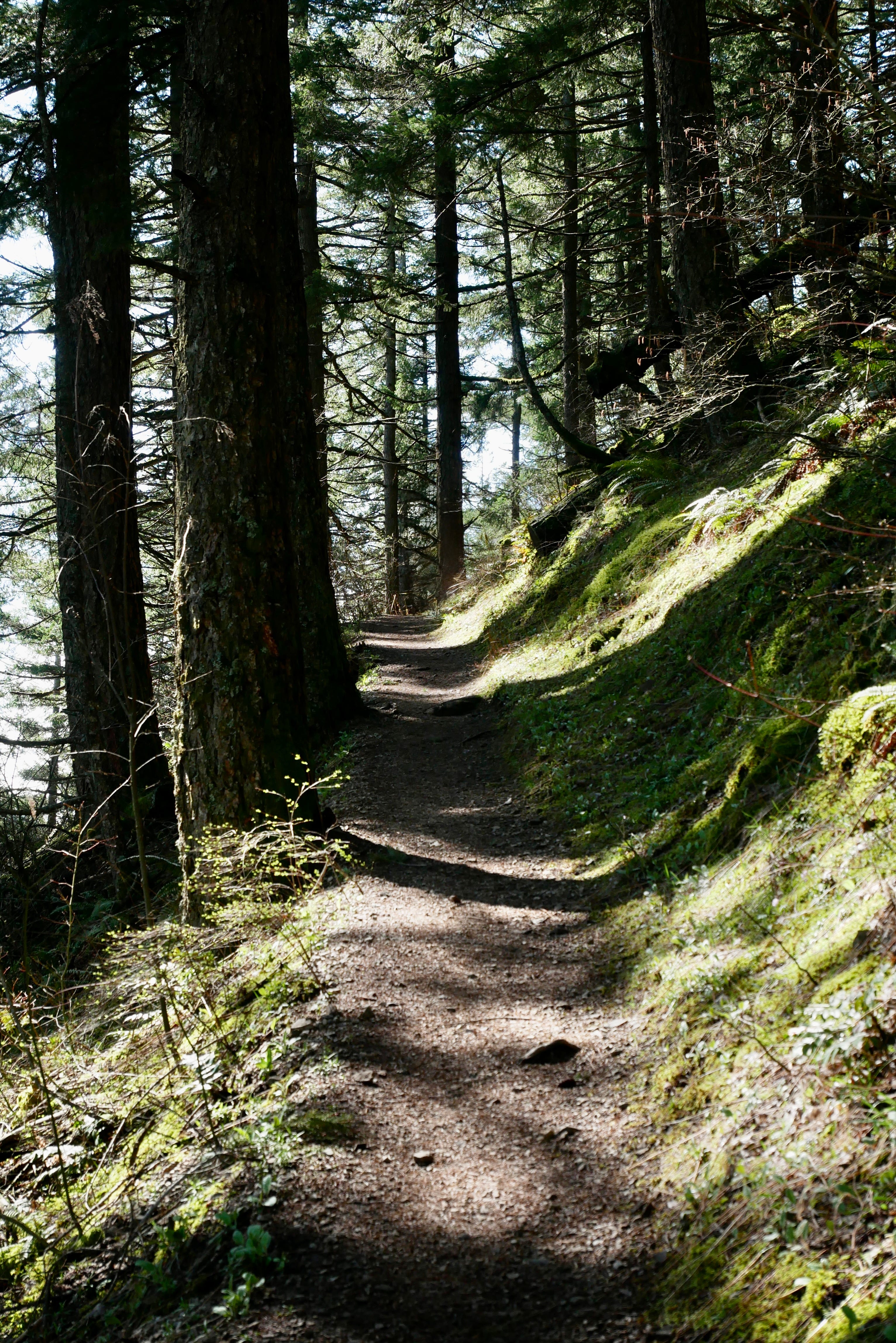
Unlike most climbs from the Columba Gorge, this one wraps around, facing away from the transportation corridor, so it’s quite serene.
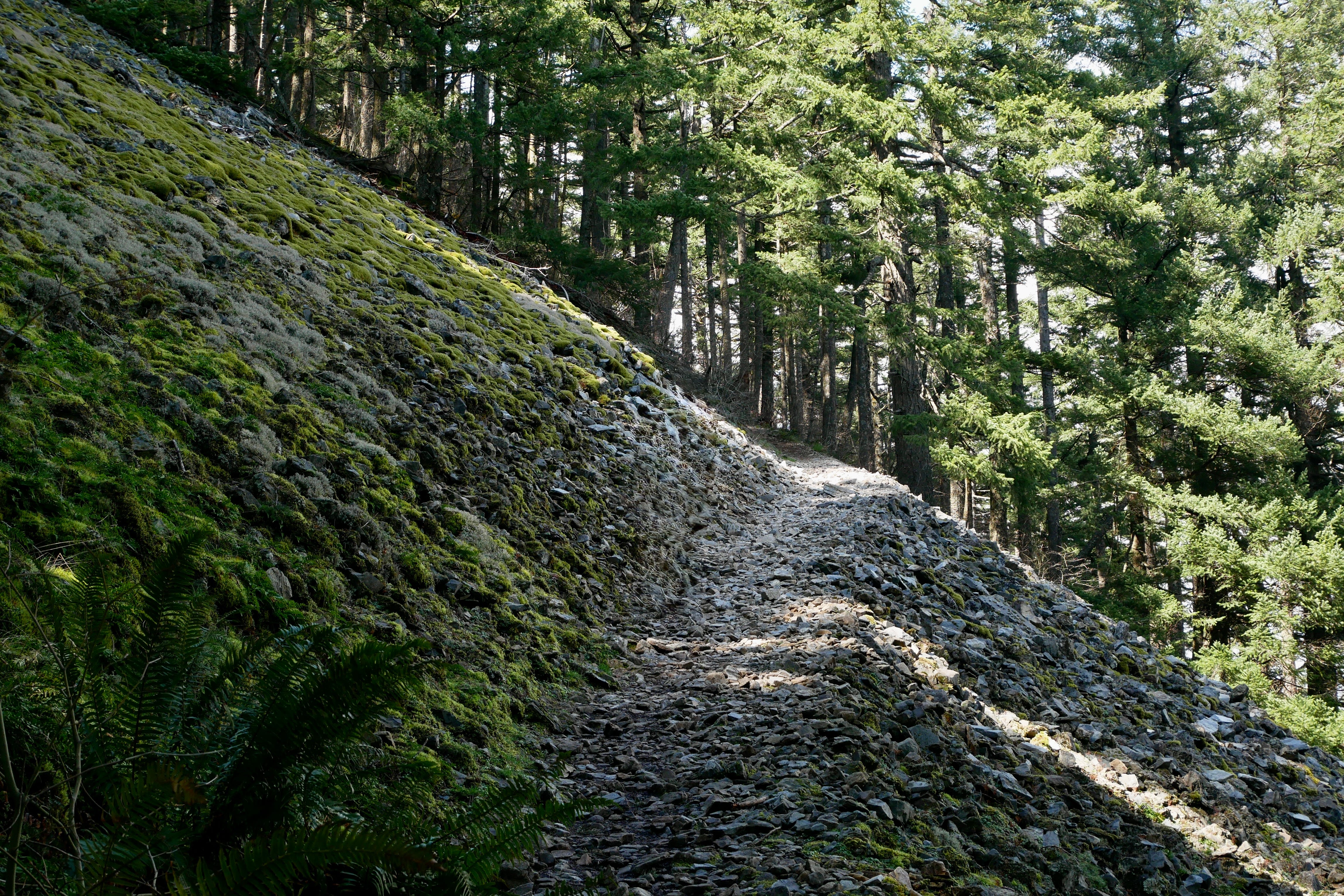
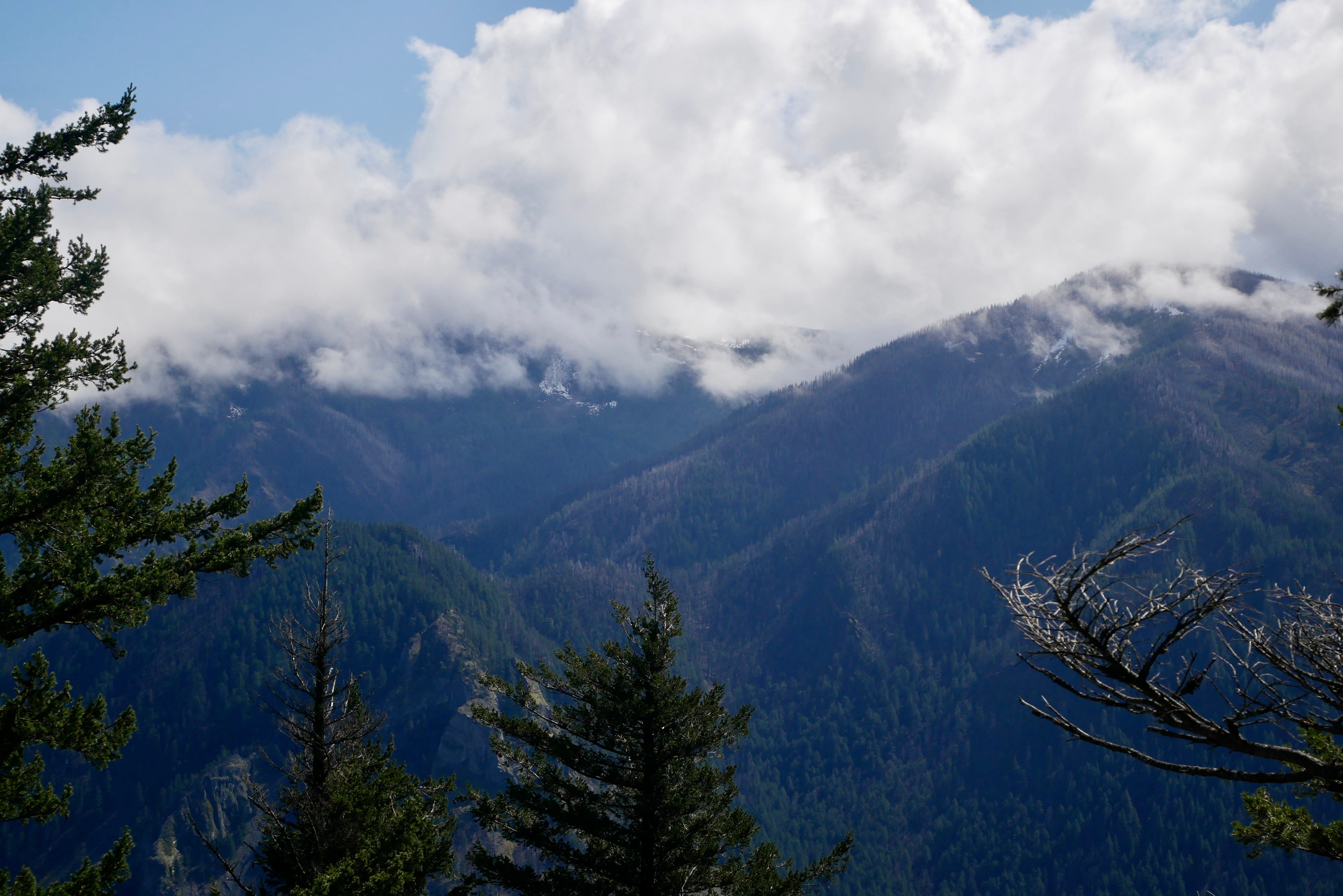
Hiking up the steep trail beneath a canopy of Douglas-fir affords views of mountains to the north. Evidence of the force for which the mountain is aptly named can be seen in a two-foot diameter tree trunk snapped like a toothpick, and in the various snags dotting the perimeter of the stand. I hear a Raven quietly calling (1:00).
As I understand it, this is where the winds that funnel down the “ductwork” of the Columbia Gorge first find a “vent”. According to Native American legend, the Great Spirit caused whirlwinds to blow incessantly around Wind Mountain as a punishment for those who violated a taboo by teaching white men how to snare salmon. Clouds and fog often shroud the top of the mountain:
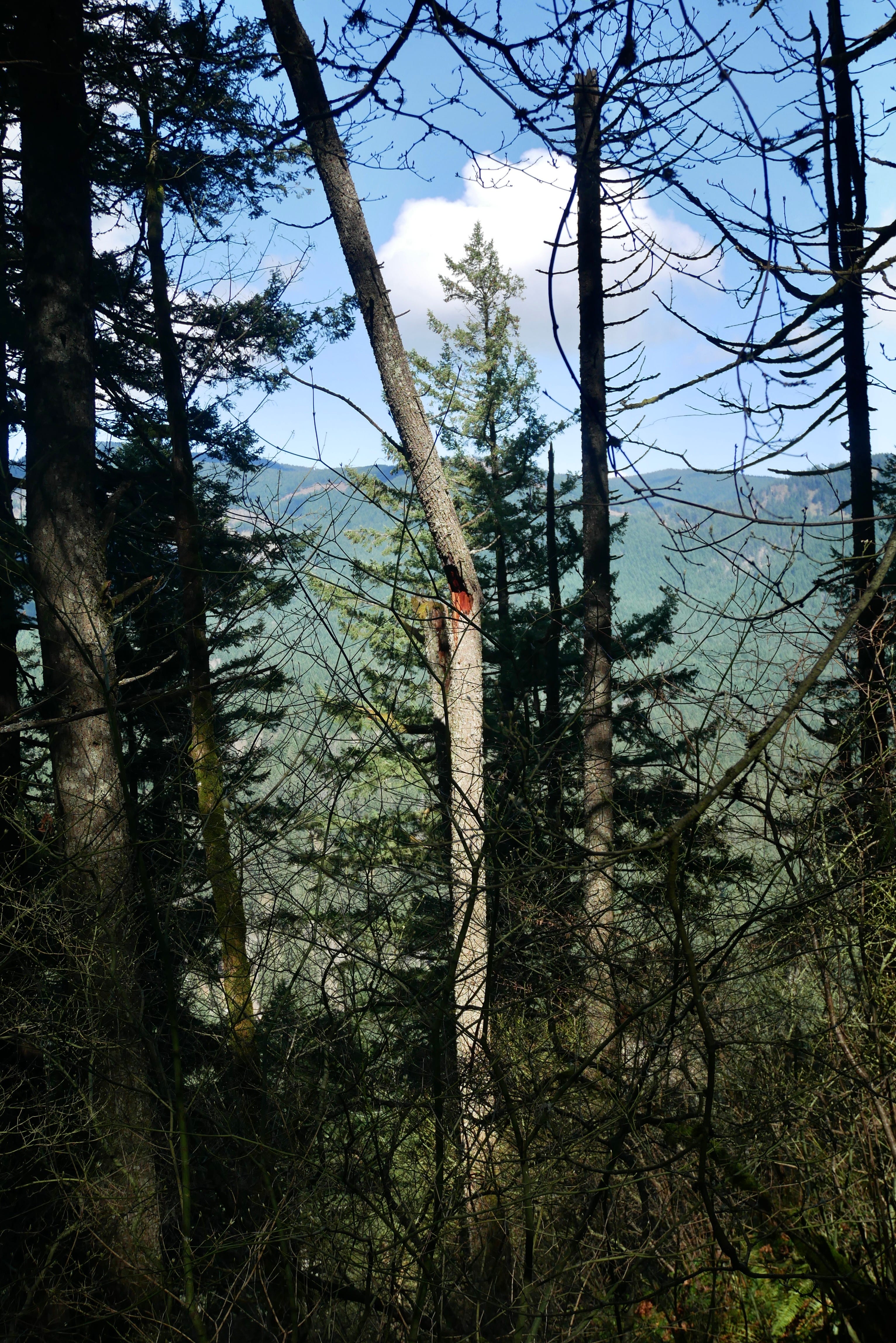
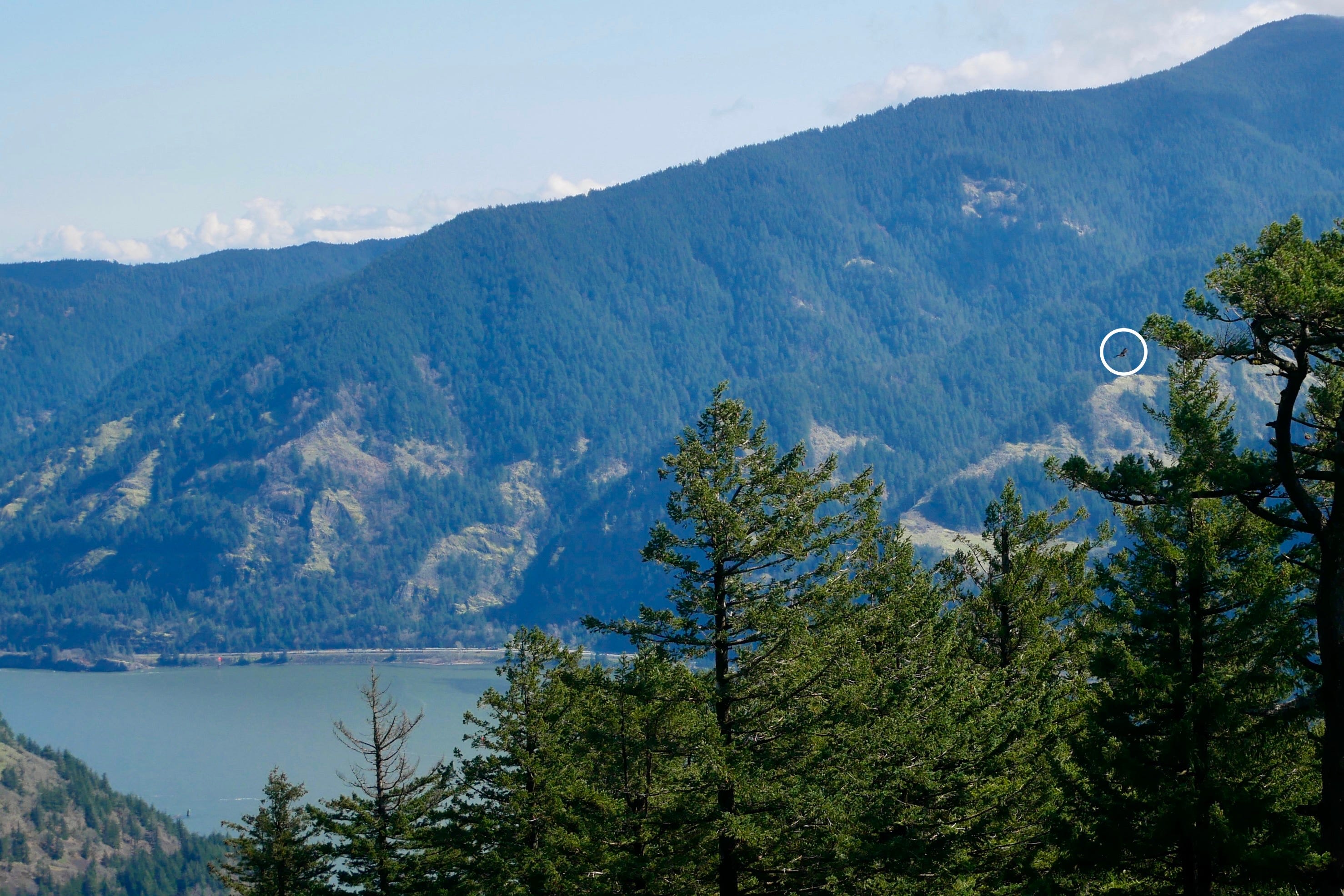
Dog Mountain comes into view between the trees. One of the gorge’s signature hikes, it now requires parking reservations on spring weekends, when the mountain meadows come alive with wildflowers. The Dog Mountain climb almost triples the elevation gain of the Wind Mountain route, so Wind Mountain offers a good training option.
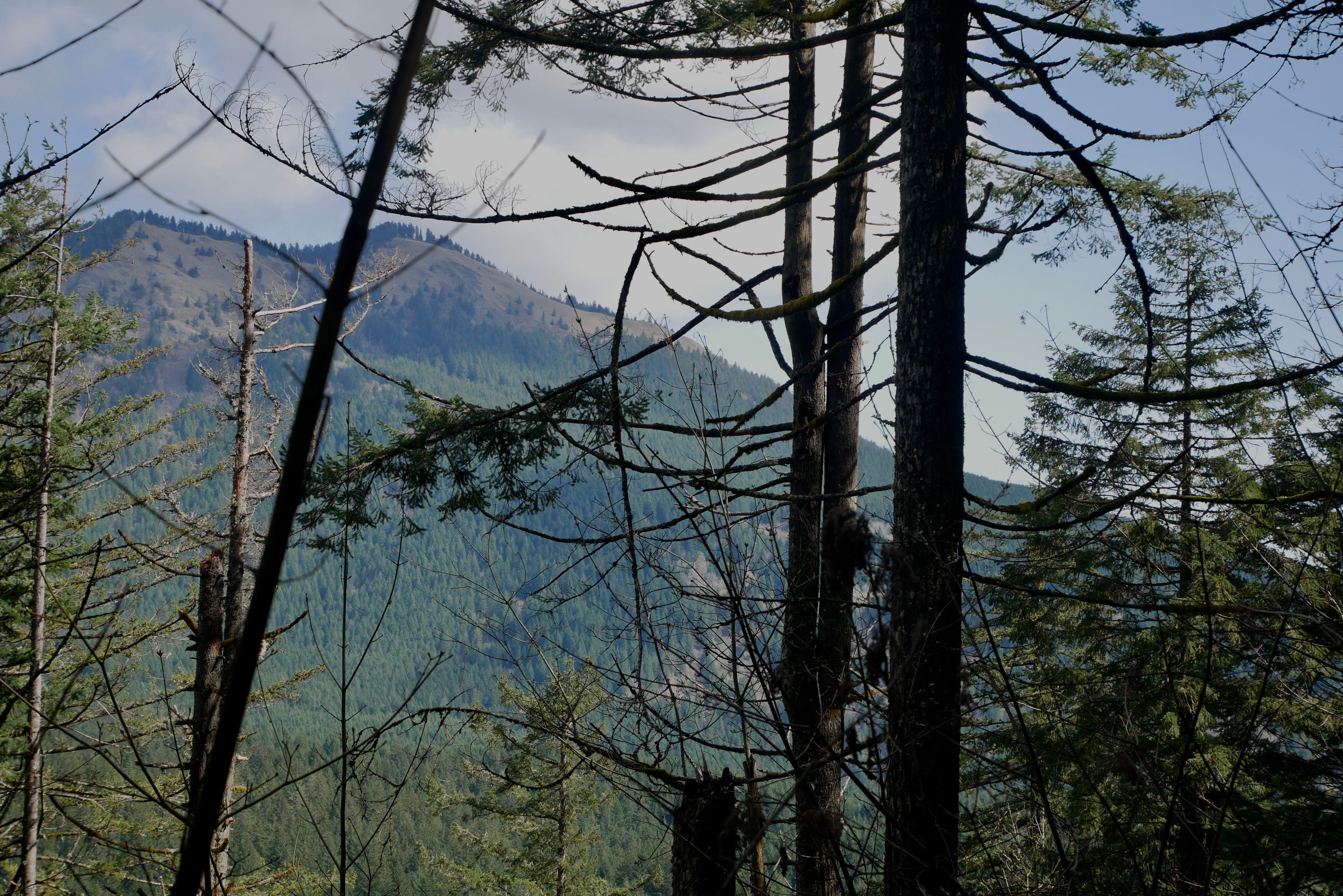
Rounding the mountain, the opposite side of the gorge and the river comes into view. The sound of highway traffic on Route 14 and HWY 84 aren’t quite drowned out by the sound of the wind today. It’s surprisingly still here. I hear a diesel locomotive groan past (3:00), followed by the soft whine of its long chain of container cars.
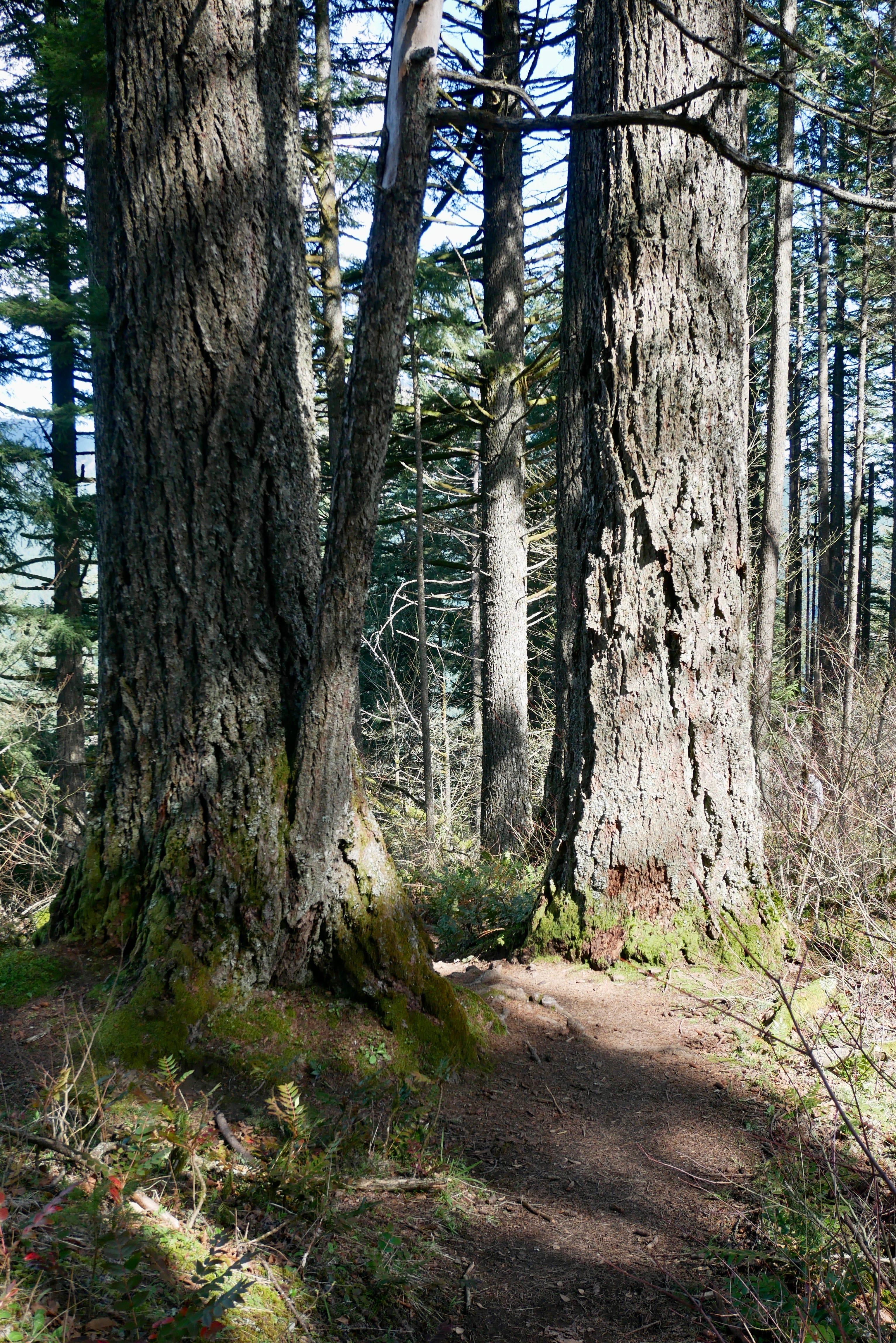
Coming to a bench, my lungs welcome a reprieve in climbing. Here the trees in the center of the stand have grown older.
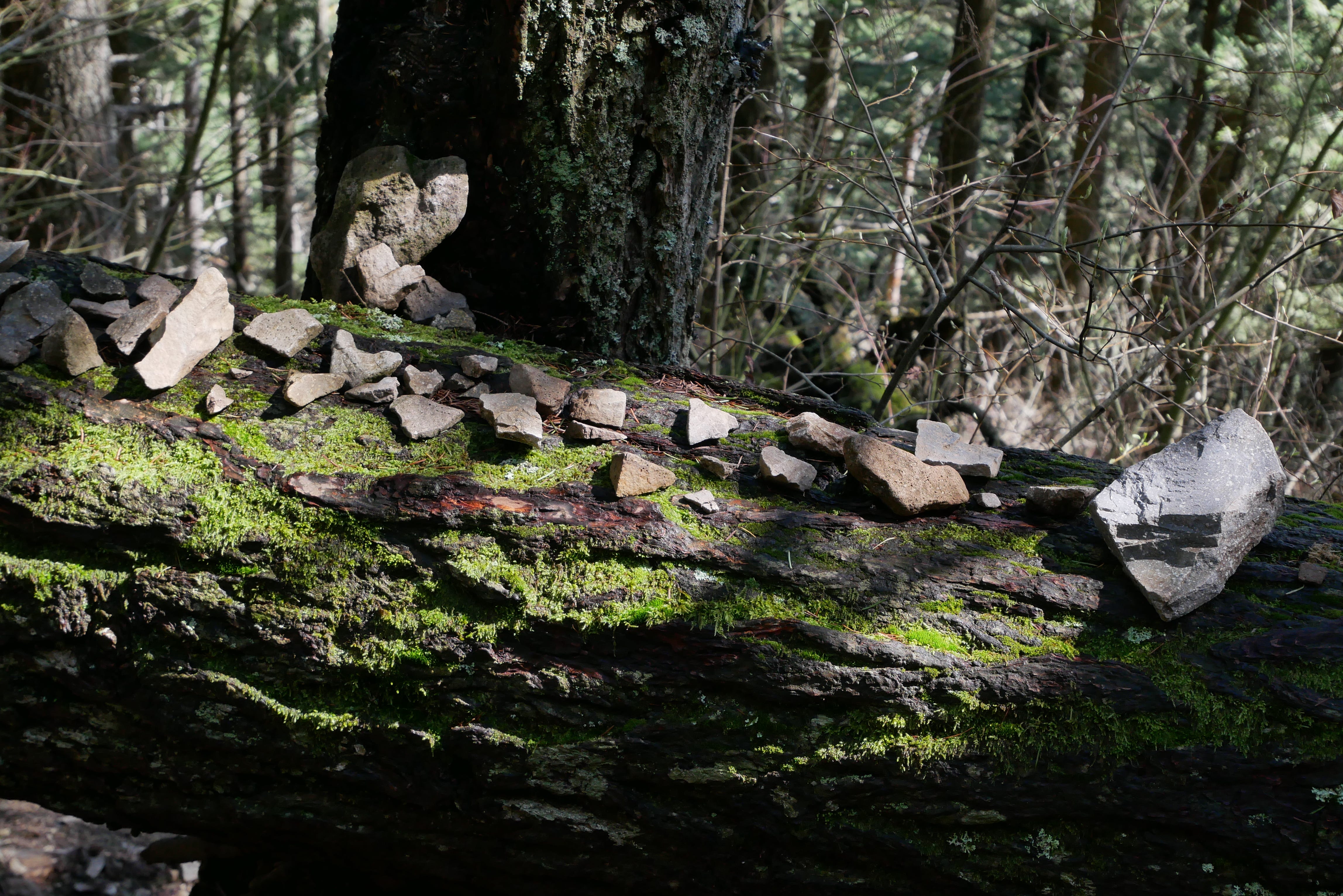
Soon the trail passes a gnarled fallen tree covered with unusual stones. Usually you encounter basalt throughout the gorge, from a formation deposited by massive volcanic flows between 17 and 14 million years ago. These are quartz-diorite from a much younger 4 million year-old intrusion, and I soon find they have an altogether different sound underfoot (5:30). Why are people bringing them to this tree? It doesn’t look like the work of one person.
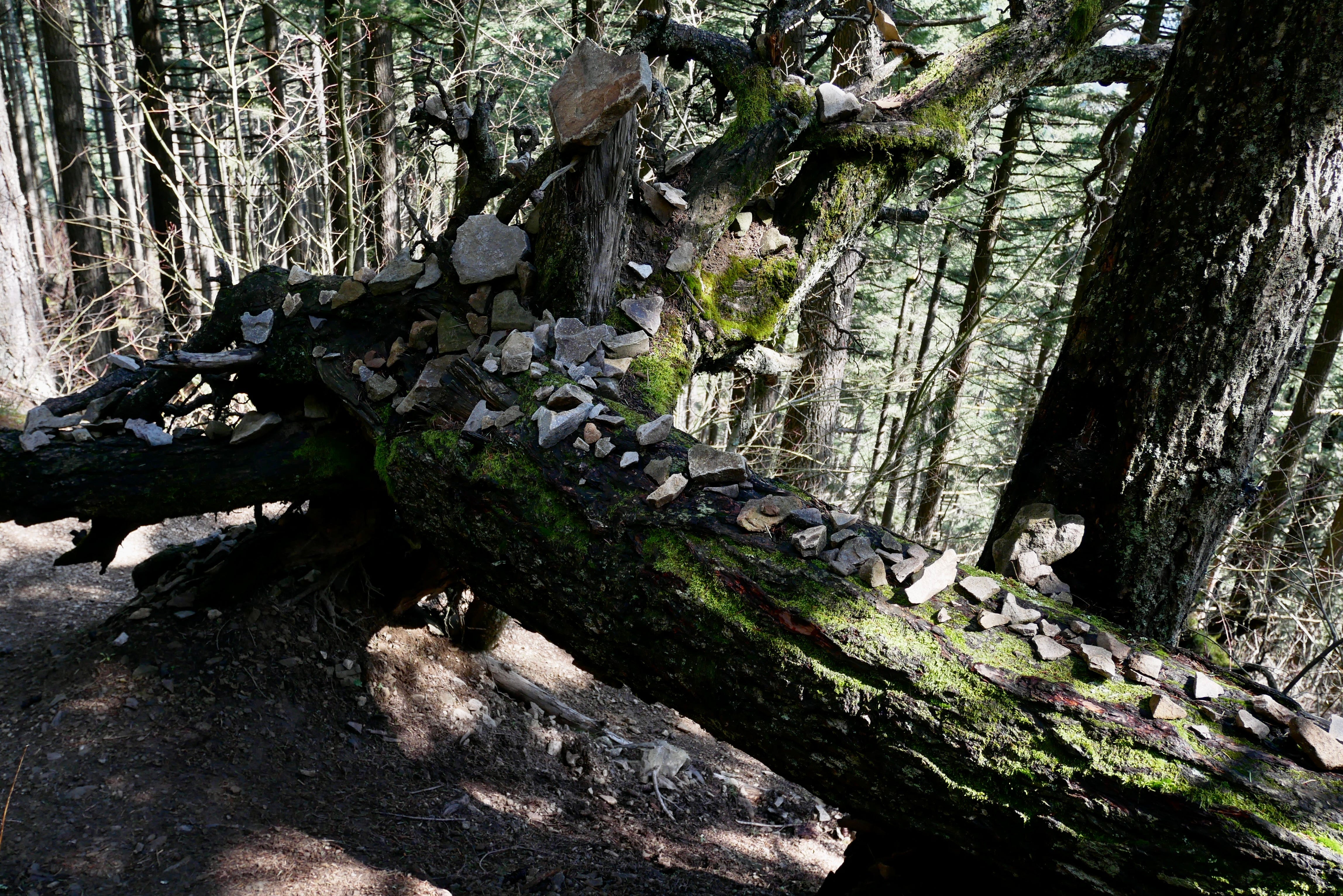
I wonder who started this, and why does it inspire followers? I reflect on this later.
As some views open up I see a Dog Mountain-shaped cloud floating above Dog Mountain:
Crossing the first Talus slope, I delight in the dense and rigid tones of the quartz-diorite underfoot, and the acoustics at play (8:00).
Red-breasted Nuthatches and Chestnut-backed Chickadees drift through the trees nearby (9:00). I hear Sooty Grouse: a deep wup, wup, wup, wup. It’s never close, but seemingly never far either. This is probably just a function of how low pitches (~100hz) can carry much further. A phantom sound. (It didn’t come through clearly on this recording because I had Low Cut turned on in my recorder.)
Nearing the top, I encounter a signpost. And, like a good 99% Invisible listener, I always read the plaque. To my delight I’m informed that just up the trail is an archeological site relating to the Native American right of passage known as spirit quest or vision quest. I had no idea.
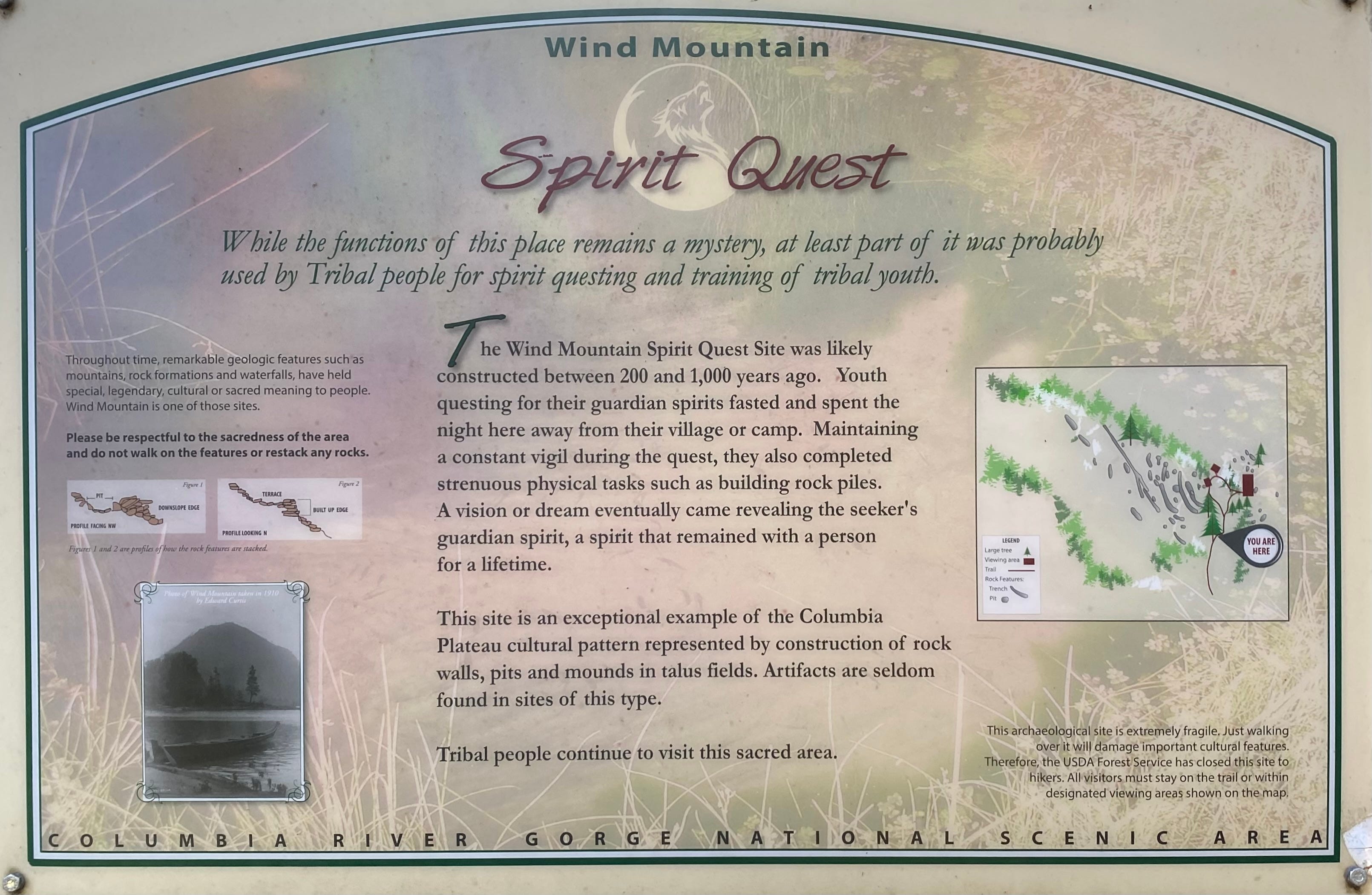
Wind Mountain Spirit Quest
While the functions of this place remains a mystery, at least part of it was probably used by Tribal people for spirit questing and training of tribal youth.
Throughout time, remarkable geologic features such as mountains, rock formations and waterfalls, have held special, legendary, cultural or sacred meaning to people. Wind Mountain is one of those sites.
Please be respectful to the sacredness of the area and do not walk on the features or restack any rocks.
The Wind Mountain Spirit Quest Site was likely constructed between 200 and 1000 years ago. Youth questing for their gaurdian spirits fasted and spent the night here away from their village or camp. Maintaining a constant vigil during the quest, they also completed strenuous activities such as building rock piles. A vision or dream eventually came revealing the seeker’s guardian spirit, a spirit that remained with a person for a lifetime.
This site is an exceptional example of the Columbia plateau cultural pattern represented by construction of rock walls, pits and mounds in talus fields. Artifacts are seldom found in sites of this type. Tribal people continue to visit this sacred area.
This archaeological site is extremely fragile. Just walking over it will damage important cultural features. Therefore, the USDA Forest Service has closed the site to hikers. All visitors must stay on the trail or within designated viewing areas shown on the map.
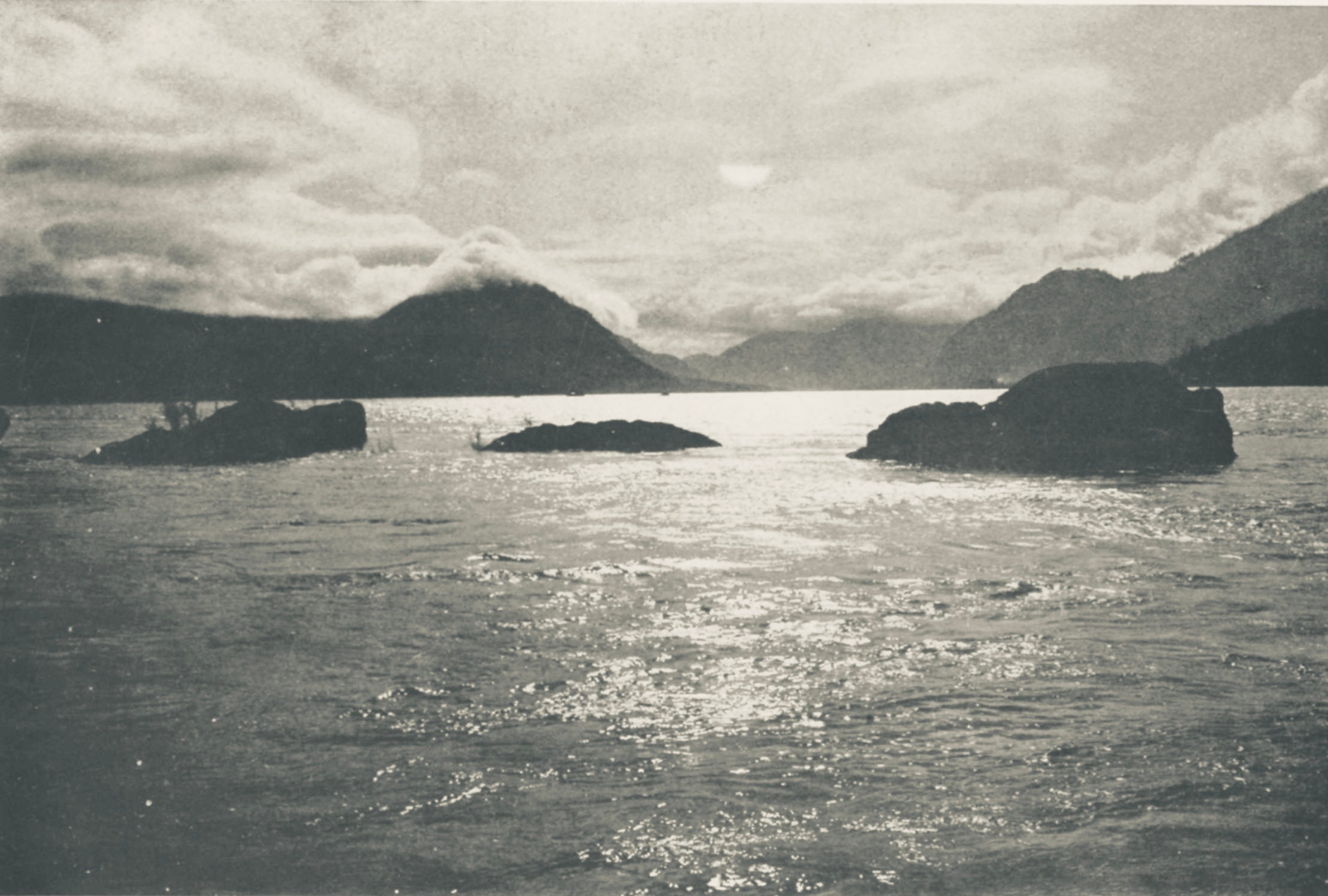
Before the site comes into view, however, we look down over the wide Columbia. In the distance I see it narrow significantly, as it curls around a tongue of forested blue-green terrain. Just beyond is the Bridge of the Gods.
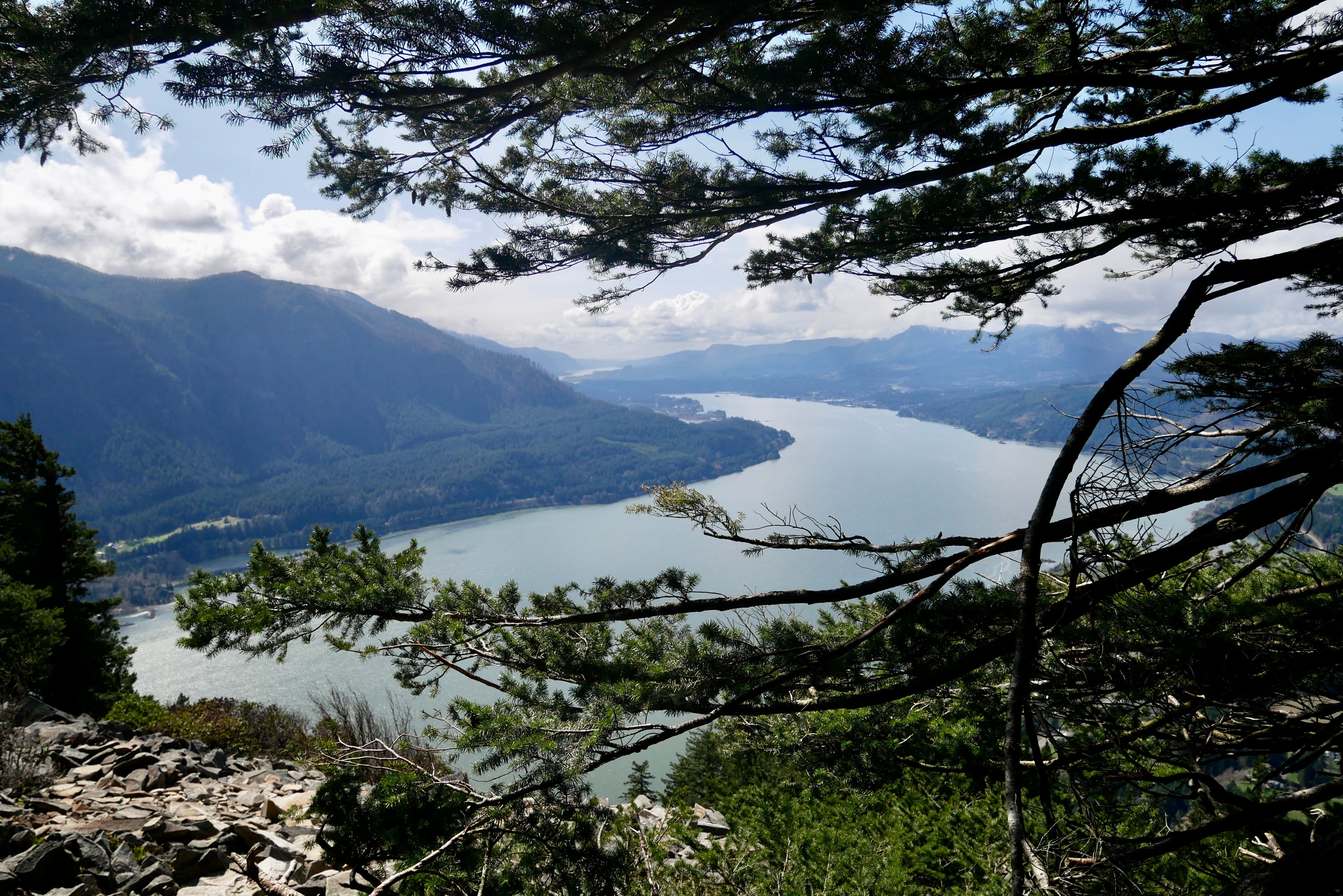
That tongue of land has only been there about 600 years. It is a massive landslide that temporarily dammed the Columbia, creating an ephemeral lake behind it, looking not unlike Lake Bonneville (water is impounded by the Bonneville Dam, just below the Bridge of the Gods) that you see today (11:00).
How do we know? It’s another win for ghost forests:
Here we see Wind Mountain with stumps in the water and along the shore, like Lewis and Clark would have witnessed passing by in 1805:

A remarkable circumstance in this part of the river is, the Stumps of pine trees are in many places are at some distance in the river, and gives every appearance of the rivers being damed up below from some cause which I am not at this time acquainted with. - Captain William Clark, 1805
These trees were submerged and drowned in the temporary lake that was created by the landslide. Over time they decayed, taking on the spectral quality of so many broken teeth on the shoreline.
Here is another view, looking east, with wonderful detail. Some piers, and many stumps can be seen on the north shore of the river;
To my understanding, none of these ghost tree stumps are visible today, given the normal water levels of Lake Bonneville.
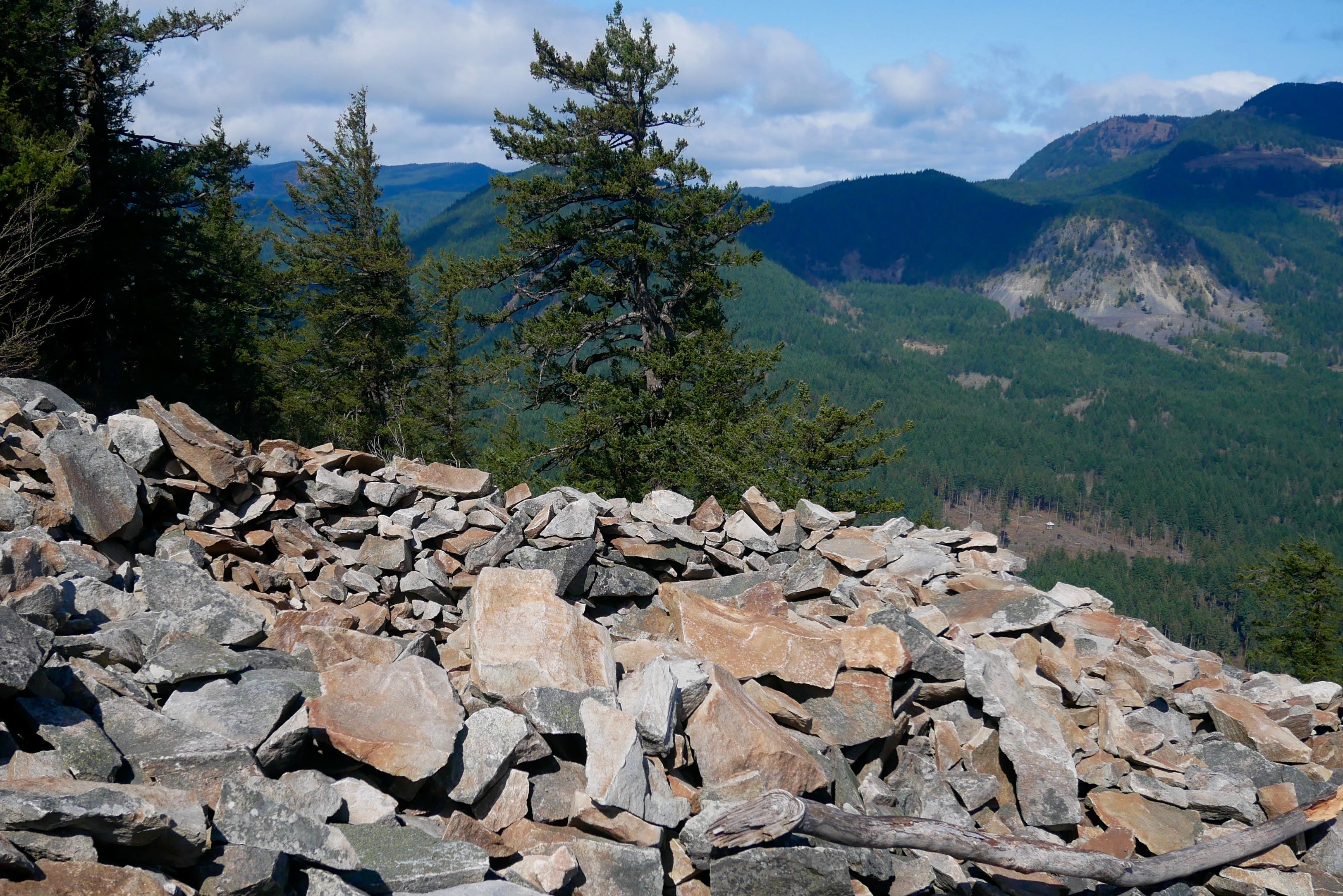
At the summit, the trail deposits the hiker at the head of a very large talus slope, sculpted by human hands, over many centuries:
It’s hard to see the pits and contours in a still photo with the afternoon light. There are at least half a dozen in this panorama. Looking closer we find one measuring about 3’ deep, and 8-9’ long:
There are also a couple rock stacks, obviously made by modern-day visitors:
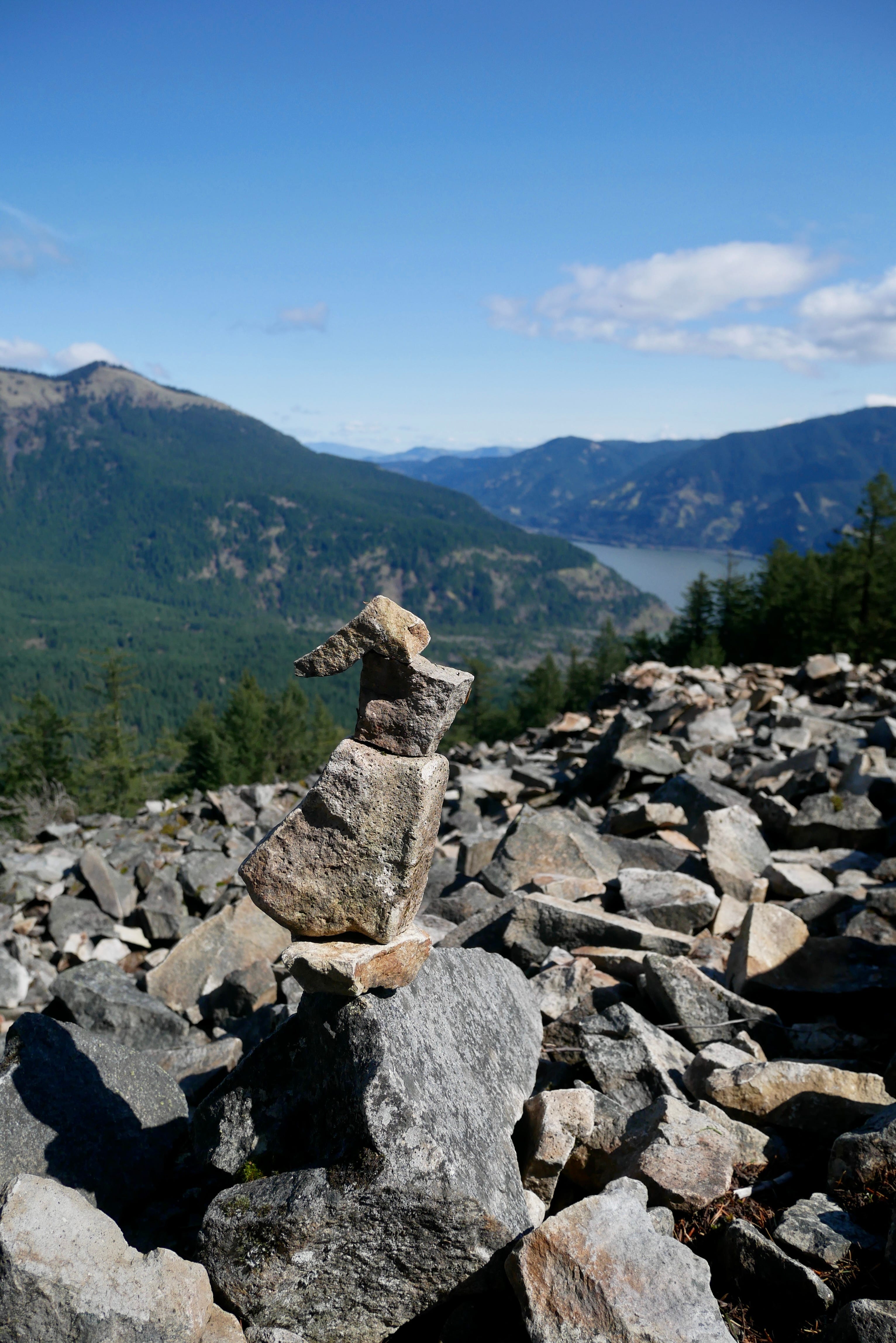
It’s a discouraging modification, but in all fairness the sign did include more information than most people usually stop to absorb. A pointed cautionary signpost at the top of the slope might remedy this. One would hope, anyway.
My son and I ate our sandwiches and some tangerines there in the lee of the breezes cresting over the mountain. We quietly shared observations. It was calm and peaceful (12:00).
I turned over questions in my mind. I wanted to know more. The diagram on the sign showed pits, and also linear constructions. I couldn’t really make out long mounds or trenches in the slope. How would a pit facilitate a spirit quest? Was it just hard work, to calm nerves? Surely the shape also served some purpose? At what age did the quest usually happen? My son’s age?
While we were there, the only animal that presented itself was a Turkey Vulture in flight:
I thought about California Condors—they were noted in the journals of Lewis and Clark, but the last documented sighting in of a wild condor in Washington state was in 1897. It seemed like Wind Mountain would have been condor habitat. But, overall I think the number of animals that might show up here at the summit would be few.
As I looked out over the pits I found myself wanting to visualize some sort of roof for them, as if they served some purpose as a shelter. Pithouses were common in the Columbia Plateau, after all. But, maybe the function of the shape was to isolate the individual, to deprive oneself of peripheral vision? To see only stars?
The closest tribe to Wind Mountain would have been the Chilluckittequaws, an Upper Chinookan people with villages at the mouth of the nearby Wind River, as well as present-day Bingen, WA and Hood River, OR with an estimated total population of 2200 in 1806. Like the tribes of Wapato Valley (Sauvie Island) their population was decimated by waves of malaria in the 1830’s.
In later research, I would discover other known sites of rock features at nearby Ruckel Ridge and Mosier, both across the river in Oregon. The Mosier Mounds Complex is much larger, and as the name suggests, features more mounds than pits.

Archeologists have posited burial site usage for the rock features at Mosier, pointing to descriptions of similar terraced features in Yakima, WA, and early 1900’s reports of grave-associated items at these sites. The article also mentions vision quests, and perhaps less likely, some relation to hunting.
The pits at Mosier seem to be in areas relatively isolated from the mounds, indicating the potential that they served a different purpose, or were built in a different time frame. This is my own conjecture, informed by a reading of Mapping the Mosier Mounds, a 1997 Journal of Archeological Science article:
Ethnographic information suggests that stone piling was part of a spiritual experience of adolescence; the labour of stone piling represented a ‘‘physical preparation for life’’.
Ultimately we may never know the precise motivation for mounds and pits, or their builders. Some experts believe the Mosier Mounds precede the ascendency of the Chinookan peoples, according to the 2001 National Register of Historic Places form. In the early 1900’s settlers assumed they were “battlements”, resembling US Civil War-era fortifications. A 1903 article in The Oregonian touting the newly developed Collins Hot Springs Resort one mile east of Wind Mountain said,
This was a favorite camping spot of the Indians and the top of Wind Mountain gave evidence of a great Indian fortress there at one time. The ruins of rock breastworks and trenches are found at every strategic point in the mountains and it is said that a great battle between tribes took place there in the remote past.
Here in the Pacific Northwest, in these temperate rainforests west of the Cascade range, so many sites of Native American inhabitation are entirely gone. They’ve decomposed into the soil. They’ve been obliterated by development. They’ve been burned and washed away by floods. All that is left, for the most part, is what was rendered in stone.
Coming down from the peak, I ruminated on this, again paying attention to the sound underfoot when crossing the talus slopes. It was as if the stones called out, beckoning the wayfarer to pick one up, to place upon the tree down the trail; a collective action shaping the landscape, leaving a spontaneous shrine. I was here.
I didn’t pick up a stone and place it on the tree. It chafes at the leave no trace dictum of being in the wilderness that I aspire to. My son and I had a little debate about a tangerine peel up at the summit. It’s organic, it’s compost, he suggested.
There are no tangerine trees up here, I observed. I tucked it in the pack and left it at that.
Will the visit to Wind Mountain have any effect on my son or I? Will it plant a seed, or adjust our bearings in the universe, if only infinitesimally? Like the individual stories behind the stacked stones, the answer is unknowable. It felt like a memory in the making though, which was enough.
I loved the old photos of the gorge area.