

Wildwood Trail Soundwalk LP
On a Wildwood Trail related note, I have an announcement: My 100th soundwalk album, Wildwood Trail Soundwalk, is also my first vinyl LP. It will be released June 26th, and is available for order through Bandcamp today! The album is a celebration of the sounds of the iconic Forest Park trail and my bespoke composition for woodwinds, electric piano and synthesizers. An early bird 20%off special will run til May 31, and LP orders will ship starting today.
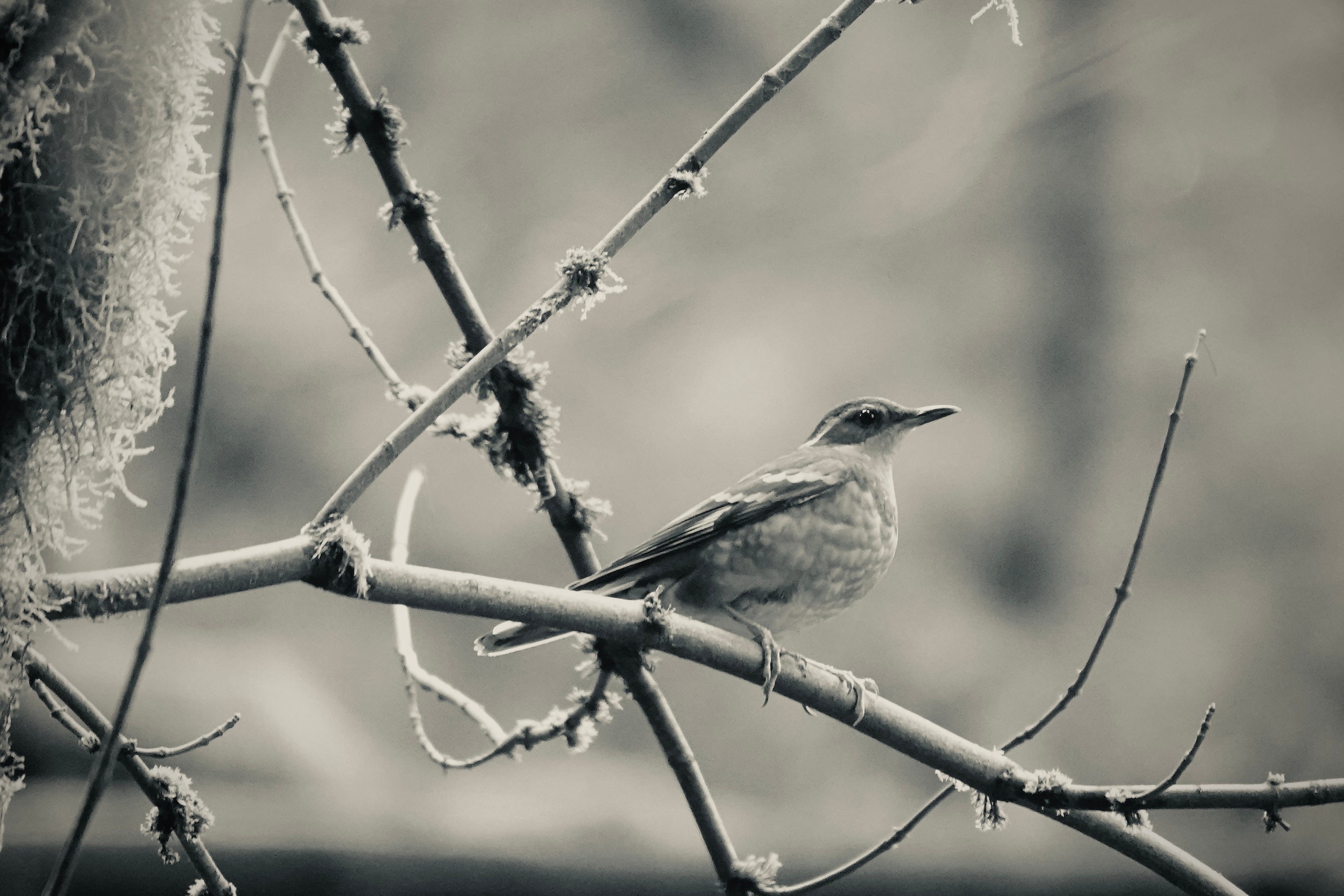
The first single “Swainson’s Thrush Meditation” is available on all music streaming services today, May 12, 2026. I’ll be sharing more about it over the coming weeks. I’m delighted to have something tangible and special to share with you. Thanks goes to MusicOregon Echo Fund and Portland Office of Arts and Culture for their support!
Now, back to the in-depth 10-part soundwalk series on the 30-mile Wildwood Trail in Portland’s Forest Park. Parts 1, 2, 3, 4 span Washington Park trailhead north to Chestnut Trail. Feel free to press play for the environmental sound as we head further north!
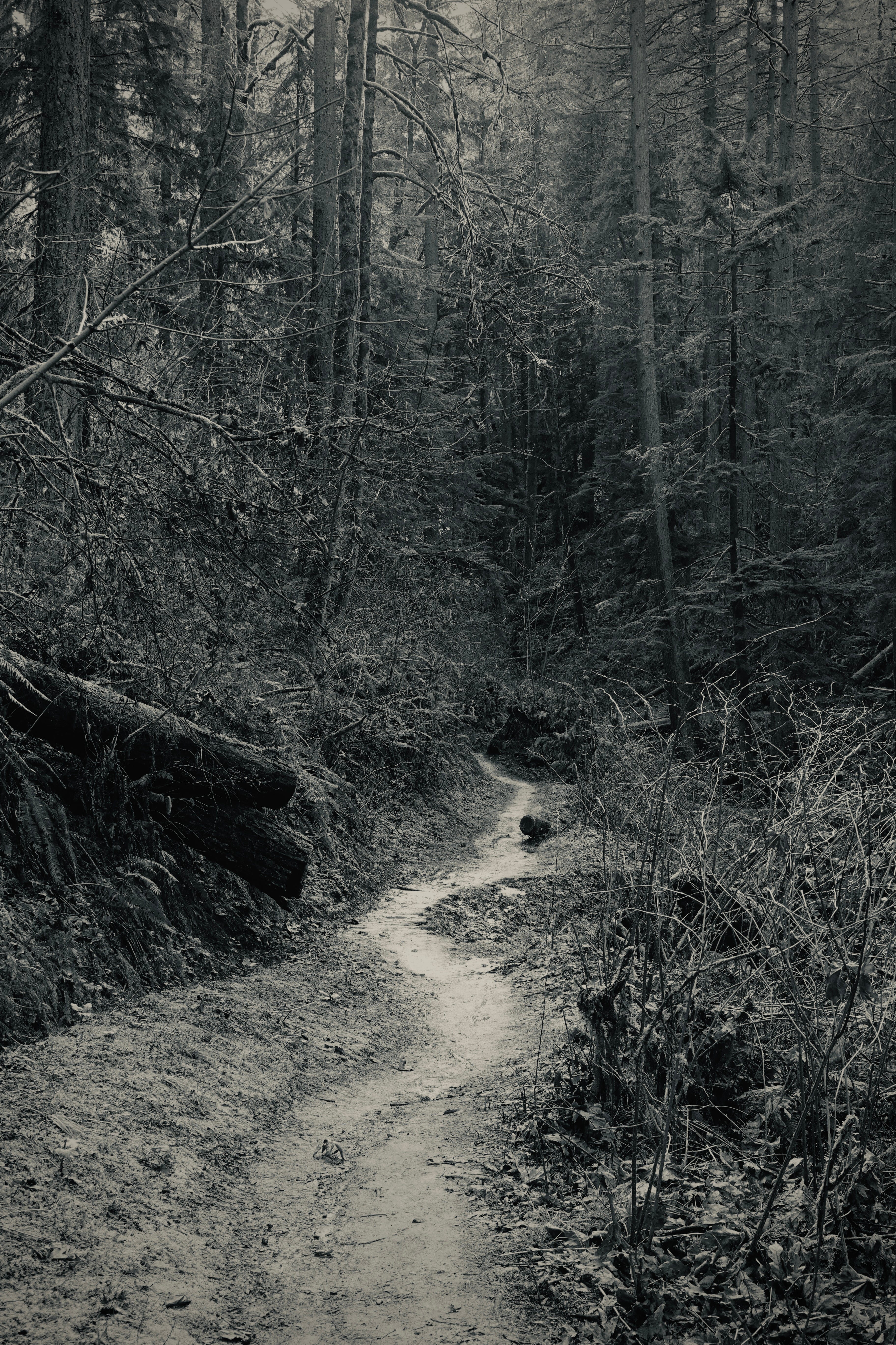
The trail drops into Rocking Chair Creek Canyon in a series of switchbacks and enters a stand the 1976 Oregonian described as “a hushed cathedral.” The big trees are here: Douglas-firs that survived the logging era that stripped most of their contemporaries from these slopes. One in particular beckons you: over five feet in diameter, growing close enough to the trail to reach out and run your hand along its bark.
How old is it? Growth rates vary by site and competition, but a Douglas-fir of this girth on the west slope of the Tualatin Mountains was likely a seedling in the 1700s. That puts its germination around the time of early European exploration of the Pacific Coast — before any settler set foot in the Tualatin Hills, before the Donation Land Act, before the logging that stripped most of these slopes bare.
Nearby Munger Creek is named for Thornton Munger, a Yale-trained forester who joined the U.S. Forest Service in 1908, and director of the Pacific Northwest Research Station in Portland. In his retirement he turned his energy toward Forest Park — chairing the Committee of Fifty, working the civic machinery, writing the history. The Oregon Journal described him in 1968 as “a crusading nature lover and conservationist” who “worked, led, pushed, cajoled, lobbied, inspired and contributed generously of his own funds,” adding that he “rebelled against greed, short-sightedness, and unmindfulness in entrenched bureaucracy.” He died in 1975, the year the Wildwood Trail was designated a National Recreation Trail.
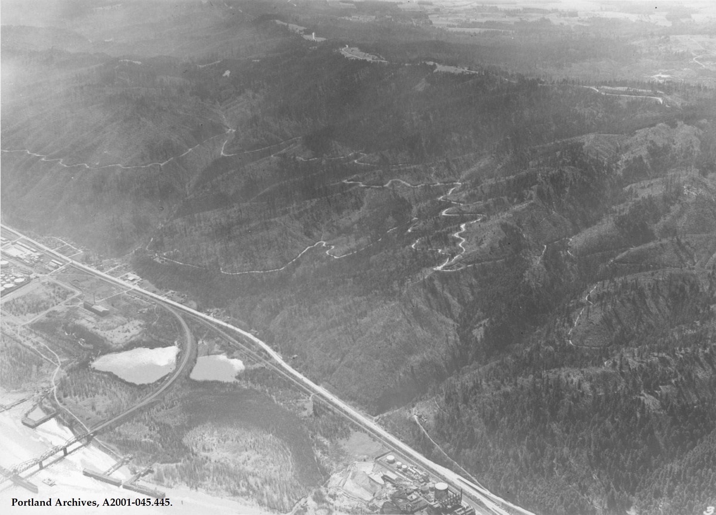
It was Munger who organized the dedication ceremony for Forest Park on September 23, 1948, and the choice of location was fitting in ways that weren’t entirely intentional. The program was held, as the Oregon Journal announced, “on the old oil well site east of Skyline Boulevard, nine-tenths of a mile north of the junction of Thompson Road and Skyline.” That site lies near the original eastward, downhill turn of the Wildwood Trail in 1968, a segment since re-named Maple Trail, before the trail was rerouted north, keeping roughly to the 800 foot elevation to navigate the deeply cut Doane Creek canyon.
Around the time the City Club was writing its 1945 feasibility study recommending the park, rumors were circulating that the geology of the Tualatin Mountains suggested oil. The City Club, recommended the city explore the possibility first, reasoning that if no oil was found, the land was suited to nothing but parkland or clear-cutting. The City of Portland leased 2,000 acres within the proposed park to the Richfield Oil Company in November 1945, with Multnomah County leasing an adjacent 3,000 acres. Richfield drilled to 7,885 feet and found nothing. They terminated their leases in September 1946.
Two years later, Munger stood at the dry well site and dedicated the park. The dedication article noted, almost in passing, that “there are only remnants of the dense woodland that once covered these hills, and few and small are the spots where virgin forest remains. One of the noblest of these even now is being cut.” At the moment of dedication, logging was still happening on privately held land inside the park’s proposed boundaries.
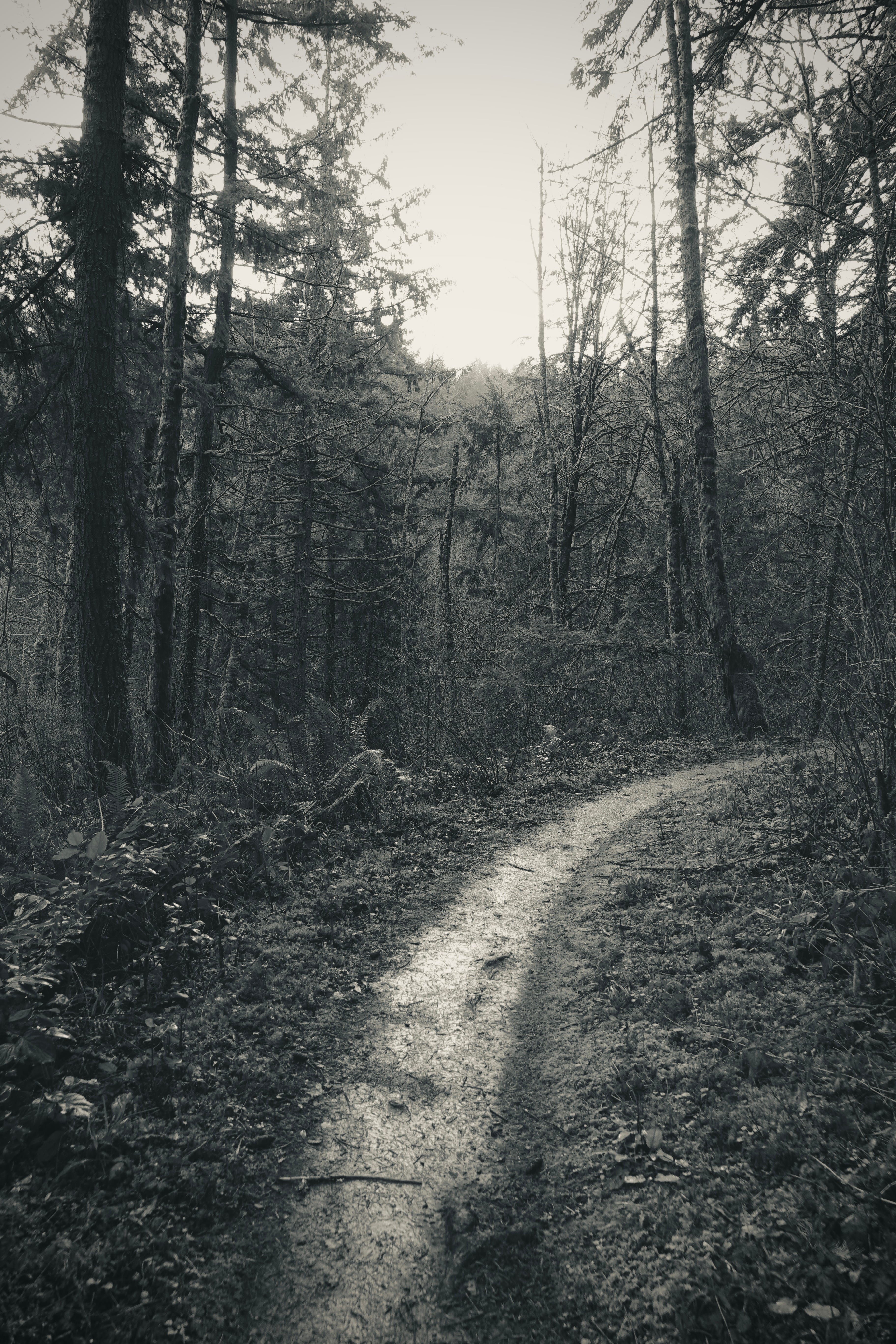
A short distance further, the character of the forest shifts noticeably. The stately old-growth gives way to a stand of younger, even-aged Douglas-firs, still decades from the spaciousness of the trees upstream. These were planted by volunteers to reforest hillsides burned in the 1951 fire that seared 1,600 acres in the park’s midsection. They are now in their early seventies. The old trees and the young ones tell different stories. Age is part of it, but not all. The ancient survivors near Munger Creek earned their character through centuries growth undisturbed. In contrast, the planted stand is in its infancy, evolving. You can see both at once on this stretch of trail.
The trail reaches Saltzman Road at the present day 16-mile mark. The 1968 Wildwood Trail alignment northern terminus was a different junction altogether, downhill (that last 1.5 miles segment was rechristened The Maple Trail, and lengthened as a different route.)
Dale Christiansen, who had directed the Youth Task Force teenagers cutting the first segments of this same trail back in 1963, was by now the Parks Bureau superintendent. He had shepherded the Wildwood Trail for over a decade. According to a 1976 article in the Oregonian, the route beyond Saltzman Road was under construction, with the goal of reaching Germantown Road. “The project will take several years to be completed,” he estimated.
Saltzman
Here the trail crosses Saltzman Road, a name associated the ill-fated development of the Tualatin Mountains.
Peter Saltzmann (the family later dropped one “n” from the surname) homesteaded roughly 700 acres near Skyline Ridge around 1893. The access route from his land down to St. Helens Rd. on one side and NW Thompson on the other became Saltzman Road, completed by 1896. By the time Hillside Drive was constructed along the east face of the Tualatin Mountains in 1914, the Saltzman Investment Company had assembled 500 acres along the drive. It was the largest single holding listed among the property owners who funded the drive’s construction, at $20 an acre assessment.
The 1914 Oregon Journal described Hillside Drive as a “scenic highway of merit,” 11 miles of gracefully graded road offering panoramic views of the Willamette Valley, Vancouver, and the volcanic peaks.
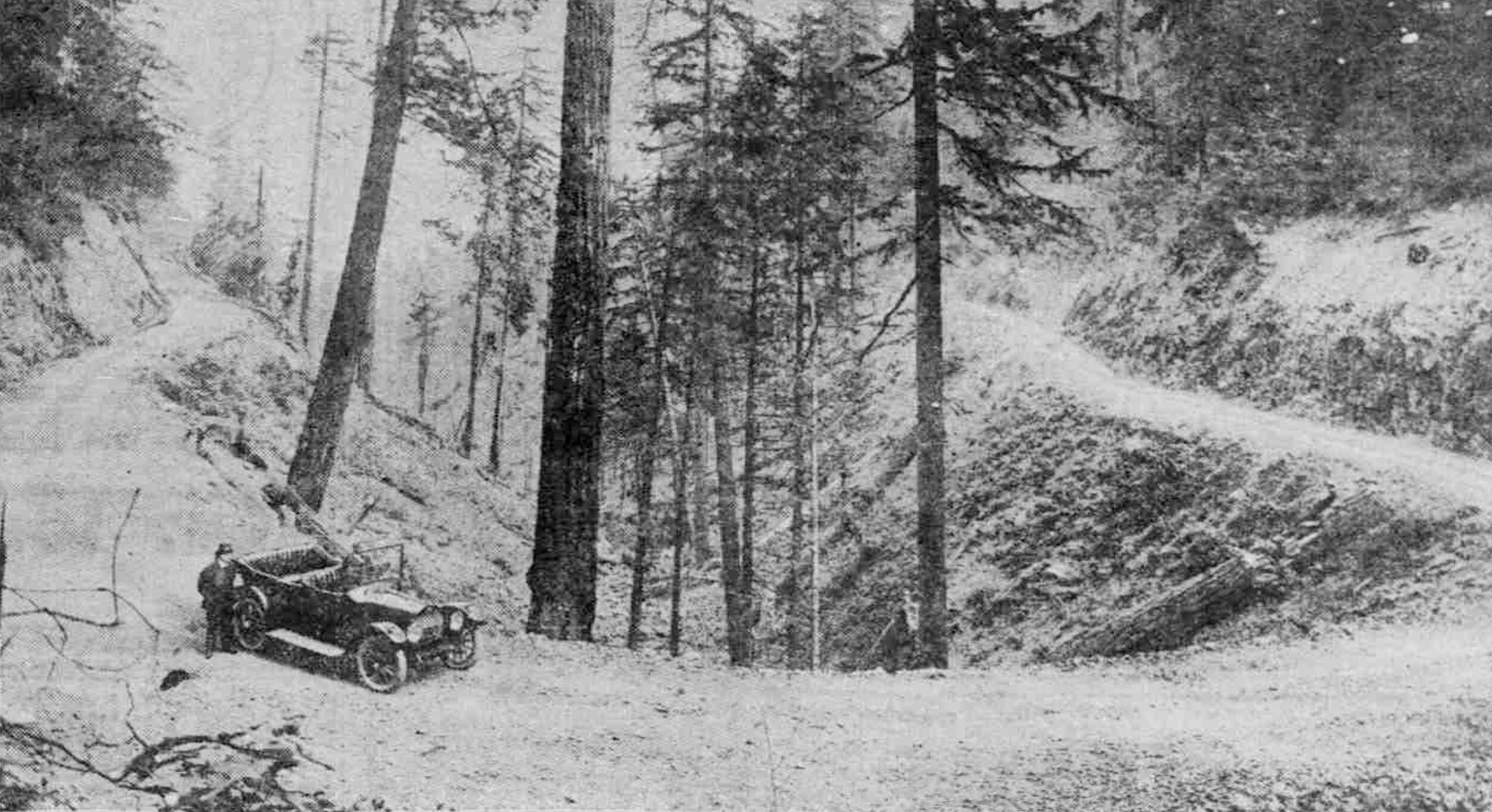
The property owners who built it expected the drive to make their lots saleable and the hills developable. It didn’t. Construction and maintenance costs proved ruinous, the city raised assessments, buyers never came, and by the 1920s hundreds of acres along Hillside Drive (Renamed Leif Erikson Drive in 1933) were surrendered to the city for unpaid taxes. As early as 1916 the Saltzman Investment Company was already sidestepping obligations. The Company’s 500 acres eventually became part of Forest Park, while the road and the creek kept the name.
Thanks for joining me on this journey, and remember to check out Wildwood Trail Soundwalk on Bandcamp.
Okay, this is so freaking cool. As a vinyl collector and obvious Wildwood Trail lover, I need this ASAP. We should do a collab event together where you play the sounds and I can sell candles...? Just a thought... :)