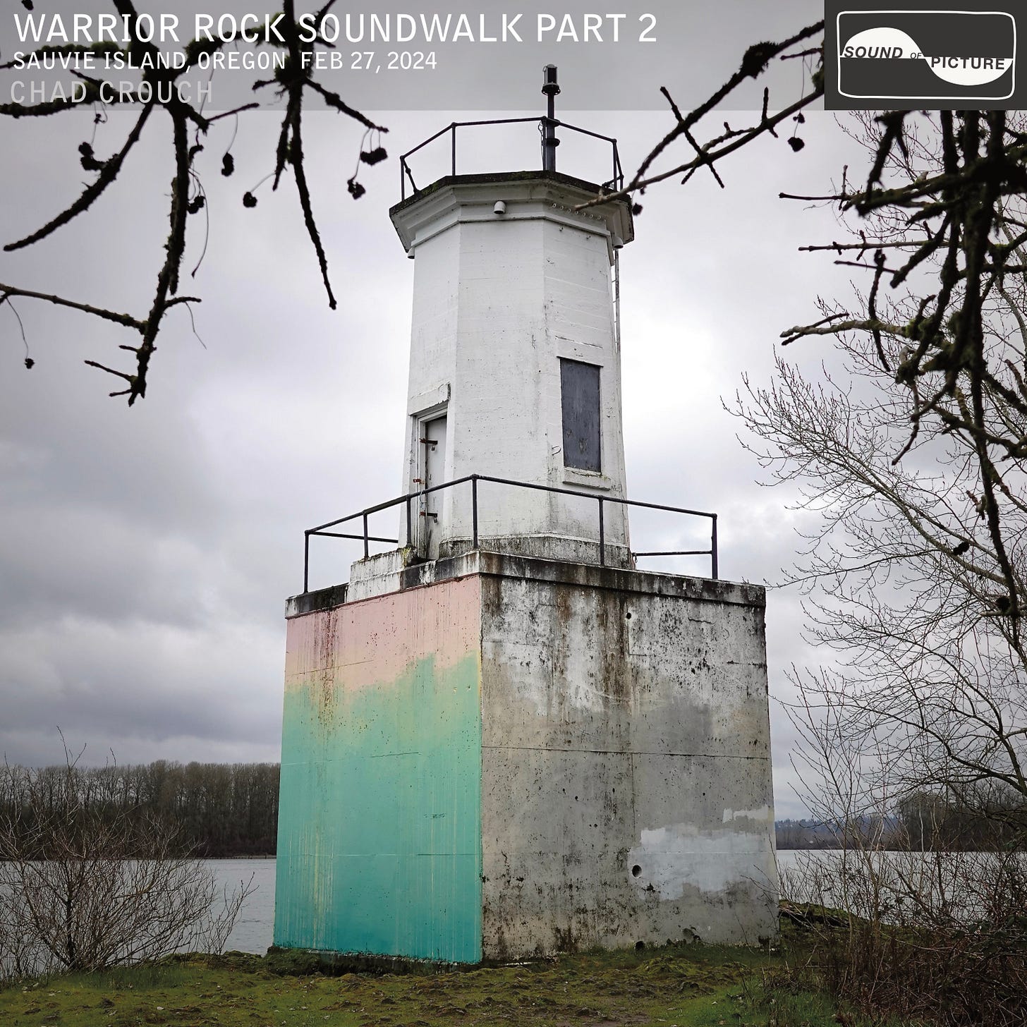
Welcome back. Let’s finish our stroll along the Columbia and find out more about this intriguing place. In the first installment we learned how Warrior Point got its name, and about and the rock formation that became the geological cornerstone of Sauvie Island. In this conclusion we arrive at Warrior Rock Lighthouse, the smallest lighthouse in Oregon, and the only one in operation far from the coastline. For this installment I must thank the kind folks at warriorrock.org for sharing several hard-to-find photos and shedding light on some scarcely known stories about the lighthouse.
Pre-contact
The closest Native American village to Warrior Point on Sauvie Island was Namuit, unmentioned by Lewis & Clark, excepting “2 Houses” drawn on a map in the vicinity of the Warrior Point trailhead is today. I suppose it is worth pointing out that “Warrior Rock” and “Warrior Point” describe two different geological places about a half mile away from each other, and are often interchanged.


In 1959 amateur archeologist Emory Stone said of Namuit, “Originally a very large village, it is now completely washed away. Banks of camp rock extend for a quarter of a mile along the river bank. Large collections were made from it as it was eroding away about the turn of the century.” He added, “[It] must have been quite old, for traces of fire are found eight or more feet deep beneath the silt.”
Warrior Point was a canoe burial ground. Native Americans practiced this form of burial all along the lower Columbia at promontory sites. Canoes were elevated or placed in trees with the dead wrapped in cedar bark blankets with their belongings. The bows of the canoes pointed toward the ocean.
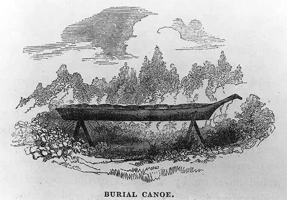
John Kirk Townsend described Mount Coffin, a canoe burial site 13 miles downriver, in his 1841 narrative:
"[the burial site] consisted of a great number of canoes containing bodies of Indians, each being carefully wrapped in blankets, and supplied with many of his personal effects in the form of weapons and implements...wrapped in his mantle of skins, laid in his canoe with his paddle, his fishing-spear, and other implements beside him, and placed aloft on some rock or eminence overlooking the river, or bay, or lake that he had frequented. He is fitted out to launch away upon those placid streams…which are prepared in the next world.”
Warrior Rock Lighthouse
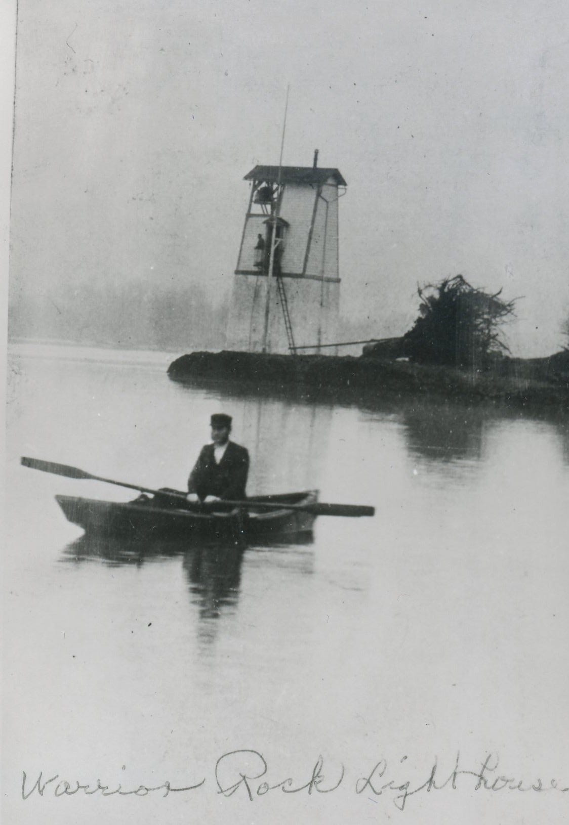
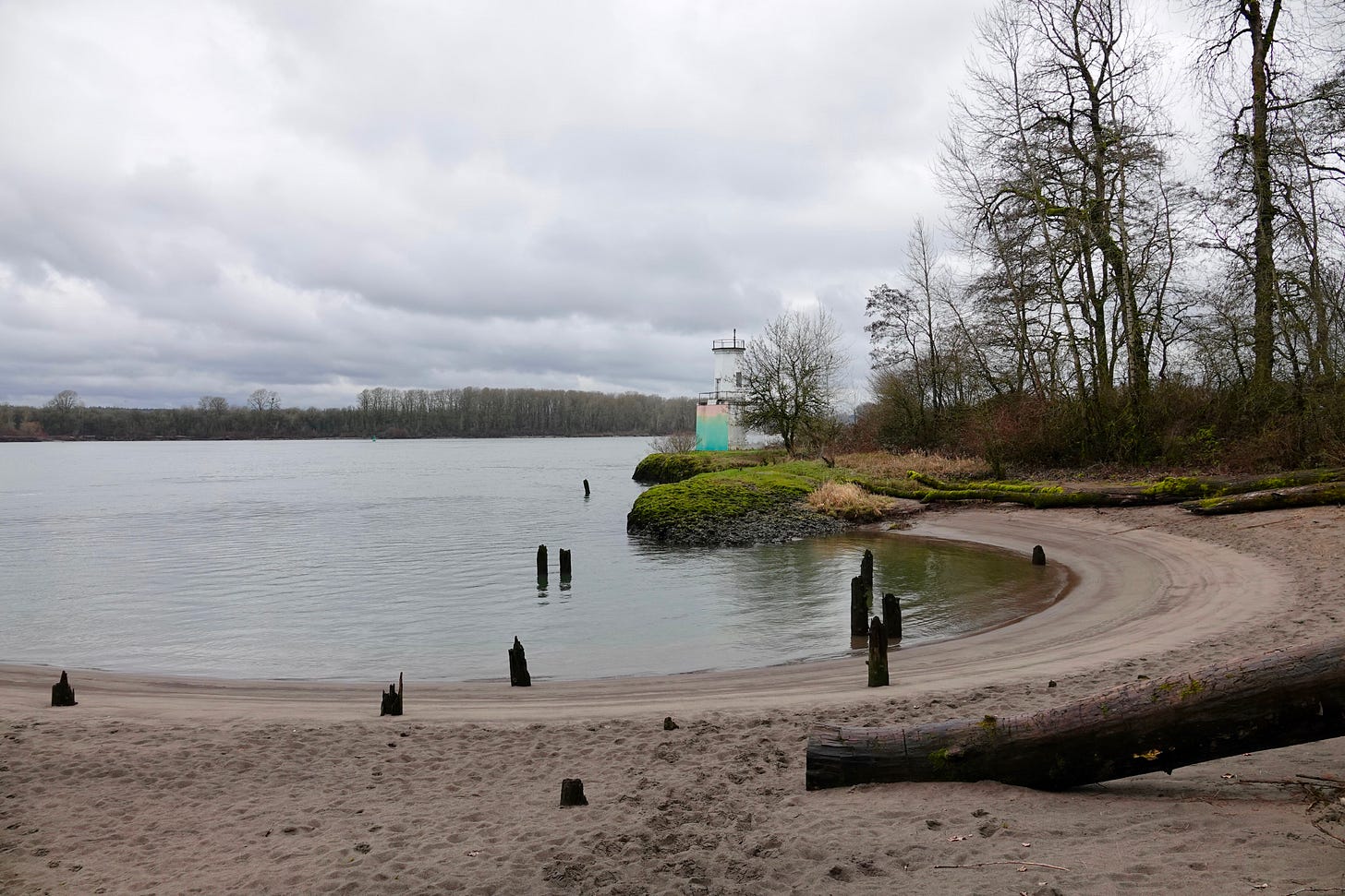
The light house was erected in 1889, a wood framed building with a shed roof on a tall sandstone foundation. The original 1500 lb. fog bell, cast in 1855, tolled for 30 years in a lighthouse at Cape Disappointment prior to installation at Warrior Rock.
In 1912, the Lighthouse Service requested $2,000 to purchase 1.61 acres near the lighthouse on which stood a “fairly good dwelling,” which was being occupied by the keeper. The desired amount was appropriated on October 22, 1913, and the dwelling and other buildings on the adjoining land were acquired by the government. (lighthousefriends.com)
Looking closely at this photo we can see quite a number of buildings, including a large mill building in the right background, where there are now none.

When the river was high, the tower’s sandstone foundation and surrounding land would often be underwater. At those times, DeRoy rode an aerial tram he concocted by stringing a cable from a tree near the dwelling to the lighthouse (lighthousefriends.com)

Waterway Woes
Warrior Rock Lighthouse has seen its share of incidents.
1898 - US revenue cutter Commodore Perry ran on a reef a short distance above Warrior Rock. “Pilots familiar with the river always give the reef a wide berth. The steamer Manzanillo had her bottom torn out there 10 years ago, and about 20 years ago the old steamship Sierra Nevada was impaled on the reef.”
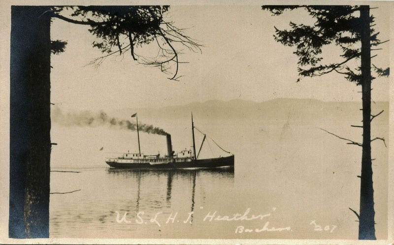
1910 - US Lighthouse Tender Heather ran aground on rocks near Warrior Rock. Not badly damaged.
1927 - The tug Cricket was sunk near Warrior Rock lighthouse when she collided head on with the steamer Wapama.
1928 - A new light to aid river navigation was established on a sunken rock about one fourth of a mile above the Warrior Rock Lighthouse.
1930 - The tug Dix which propelled the barge Swan and provided electric current to the floating dance pavilion was found in 50 feet of water a short distance above Warrior Rock lighthouse. Eight people were killed in the collision with the schooner Davenport.


1969 - The lighthouse was struck by a barge. While surveying the damage, the 1500 lb. bell fell to the shoreline and cracked.
The bell now resides at the entrance of the Columbia County Courthouse.

The current lighthouse owners added, “The lighthouse gets hit by boats more frequently than we would expect. We've heard of two instances in the 90’s.”
The Warrior Rock formation creates an unusual depth near shore of about 50 ft. Possibly more. “We've seen fishermen catch and release some crazy huge sturgeon there,” the owners shared. One wonders what detritus may have found repose in those waters.
Lighthouse Keeper’s Home For Sale
In my research I found a 1973 Oregonian real estate ad listing the lighthouse caretaker’s home, a shop, and two acres offered at $39,000. Perhaps we can conclude this was the government liquidating obsolete structures, following lighthouse rebuilding and modernization?
Adjusted for inflation that’s about $280,000 in 2024 dollars. That may sound cheap to some now, but I suspect it would have required a unique buyer then. Here is another photo showing the bungalow in relation to the lighthouse from the early days, circa 1905. Looks like a peaceful homestead!

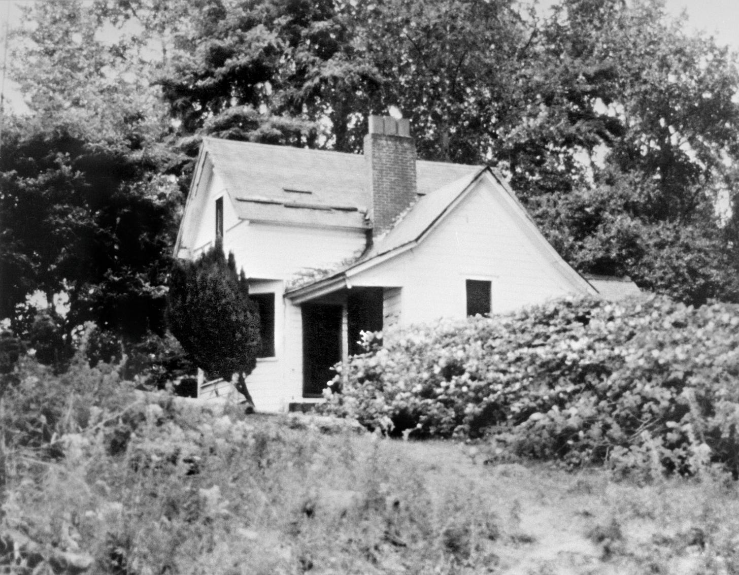
Here is a closer look at the home—date unknown—but given the size of the trees in the background and what looks like a composite shingle roof, I’d guess the 1960’s?
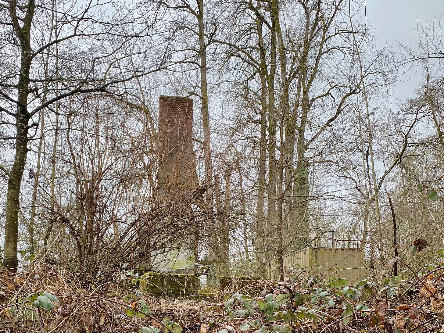
Here it is today:
The house burned down in the early 1990’s. The current property owners say, “We've heard from one of the people involved who hiked out to see the place one day that a couple of teenagers were out there when they accidentally caught the place on fire. They tried to get the Sauvie Island Fire Department out there, who announced it wasn't their jurisdiction, and then the St Helens/Columbia County services also claimed it wasn't theirs. They finally got their fathers out there to try to put it out but at that point it was too late.”
The trail to the lighthouse today leads by a discretely positioned shipping container near the freestanding chimney and foundation of the old home. It is still private property. The current owners have a website about the lighthouse and environs at warriorrock.org. Much to my surprise and delight, one of them is a musician, sound artist, composer, and educator. So cool!
St. Helens Shipbuilding Company, Island Lumber Company
Many derelict features of post-Euro-American settlement human activity can still be found all around the point: pilings, bricks, concrete, rotting wood and rusting pipe.
The pilings on Warrior Point represent the remains of the Island Lumber Company, part of a large complex of lumber industries located on the northern part of Sauvie Island and directly across Multnomah Channel at St. Helens during the late 1800s and early 1900s. Sawmills were established as early as the 1850s in St. Helens. By 1874, Charles and James Muckle operated a mill in that city and owned interests in nearby timber. In 1904 the mill burned and in 1909 the Charles R. McCormick Company bought the site and constructed a new mill. The new mill proved to be extremely productive. To accommodate larger ships than the schooners, that were the most common means of shipping, Charles McCormick formed the St. Helens Shipbuilding Company at a site just south of Warrior Point on Sauvie Island. After the acquisition of additional timber lands, he and his brother Hamlin formed the St. Helens Timber Company in 1912. In 1920, the McCormicks contracted to produce 250 million feet of railroad ties. To fill the order they formed the Island Lumber Company and built a mill and a shipping pier at Warrior Point on Sauvie Island. (ifish.net)
One of the most storied ships turned out by the St. Helens Shipbuilding Company was the Wapama, launched in 1915, surviving almost 100 years before being dismantled in 2013. Once part of the National Maritime Museum in San Francisco, it was the last example of some 225 wooden steam schooners that served along the Pacific coast. The NMM still hosts a PDF of the Wapama brochure. Detail-oriented readers may recall it was Wapama that was involved in a collision that sunk the tug Cricket off Warrior Rock in 1927.

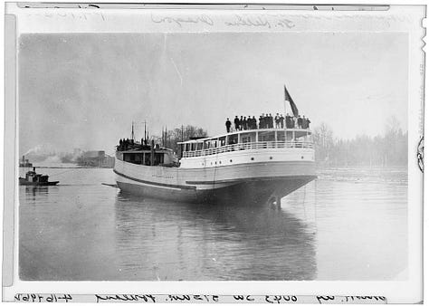
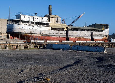
Between 1912 and 1927 the St. Helens Shipbuilding Company on Sauvie Island just south of Warrior Point launched 42 wooden ships. (Wikipedia)
Conclusion
And so we come to an end in our learning and listening series in this place once called the Wapato Valley. Little more than 200 years ago it was the domain of the Chinookan people. Today it is a bustling corridor of commerce, industry, and recreation too. Here Sauvie Island Wildlife Area, Ridgefield National Wildlife Refuge and Shillapoo Wildlife Area create an aggregated wildlife conservation area on both sides of the Columbia measuring about 20,000 acres in total. In many ways, these lands are little changed.
Warrior Rock Soundwalk Part 2 is notably quieter than Part 1. In truth, the soundscape isn’t particularly quiet here. It feels quiet, but there is a low frequency hum produced by I-5 and Hwy 30 that settles in here like a fog. I removed much of that with a low shelf EQ to approximate a less industrialized time. And, much like the nearby Oaks to Wetlands Trail Soundwalk yielded an anthropogenic alternative soundscape with Four Trains, I could have made a nautical version from the cut-outs here: Four Ships? Another time, perhaps.
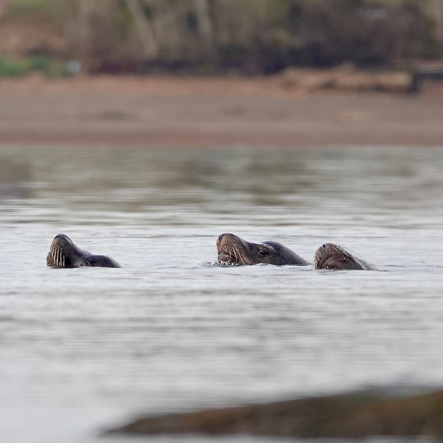
On the way back we hear the groaning of sea lions out in the middle of the river. This is a photo I snapped on a the opposite shore five days earlier. I love the sweetening of the acoustics at this distance.
Thanks for joining me on this survey of sights, sounds and stories from the Wapato Valley!
Warrior Rock Soundwalk Part 1 is out now on all streaming services.
Warrior Rock Soundwalk Part 2 is available on all streaming platforms (Spotify, Apple, Tidal, Amazon, YouTube…) tomorrow, Friday, December 20th.
Listen to this episode with a 7-day free trial
Subscribe to Soundwalk to listen to this post and get 7 days of free access to the full post archives.


