I just want to spend a little time talking about two things related to the release today of my album Columbia Lowlands Soundwalk. 1) My approach to field recording and, 2) A Vancouver Lake Lowlands historical overview.
One thing I should clarify is “Columbia Lowlands” is a place name of my invention for the album title. Vancouver Lake Lowlands sounded, frankly, provincial. This is the opposite of what I hoped to convey, as you will find. Also, this is the first in a five part soundwalk series covering this region, to roll out over the next 10 weeks. So with that out of the way, please feel free to roll the excerpted audio and read on!
My Approach to Field Recording
In a word, it’s escapist.
When I first thought to record my walks start to finish, it was in large part a response to getting frustrated with gear placement, set-up times and the invariable intrusions (aircraft, motor vehicles, trains, landscape maintenance machinery, chatty hikers and so on). Moreover, once it was up and rolling, a sense of tedium could sometimes creep in while I remained nearby, quietly minding the recorder.
In contrast, the first few soundwalks that I made were mostly faithful to the whole of what I heard on the walk. I didn’t cut out the hikers, helicopters, and so on. I would dial down the low frequency hum of the city, without attempting to remove it entirely. Just a light cleaning, if you will.
As I added new albums to the series, and my audience grew, I often found myself rationalizing removing more and more sound intrusions, to the extent that I was editing the recordings to effect a pre-industrial ideal; Just nature, hold the people and machines.
Recording at Vancouver Lake Lowlands brought this challenge into sharp focus, given there’s every form of transportation (boat, train, and motor vehicle) routed along the river on both sides, as well as a steady stream of aircraft coming and going from Portland International Airport and Vancouver’s Pearson Field.
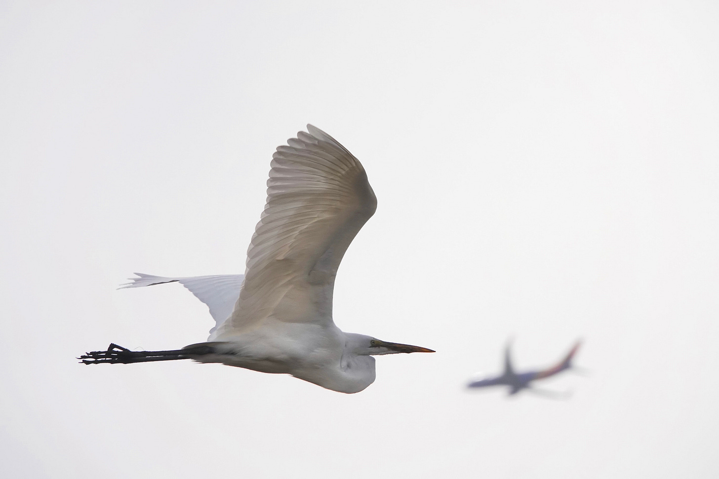
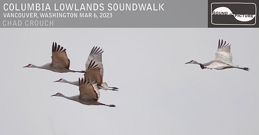
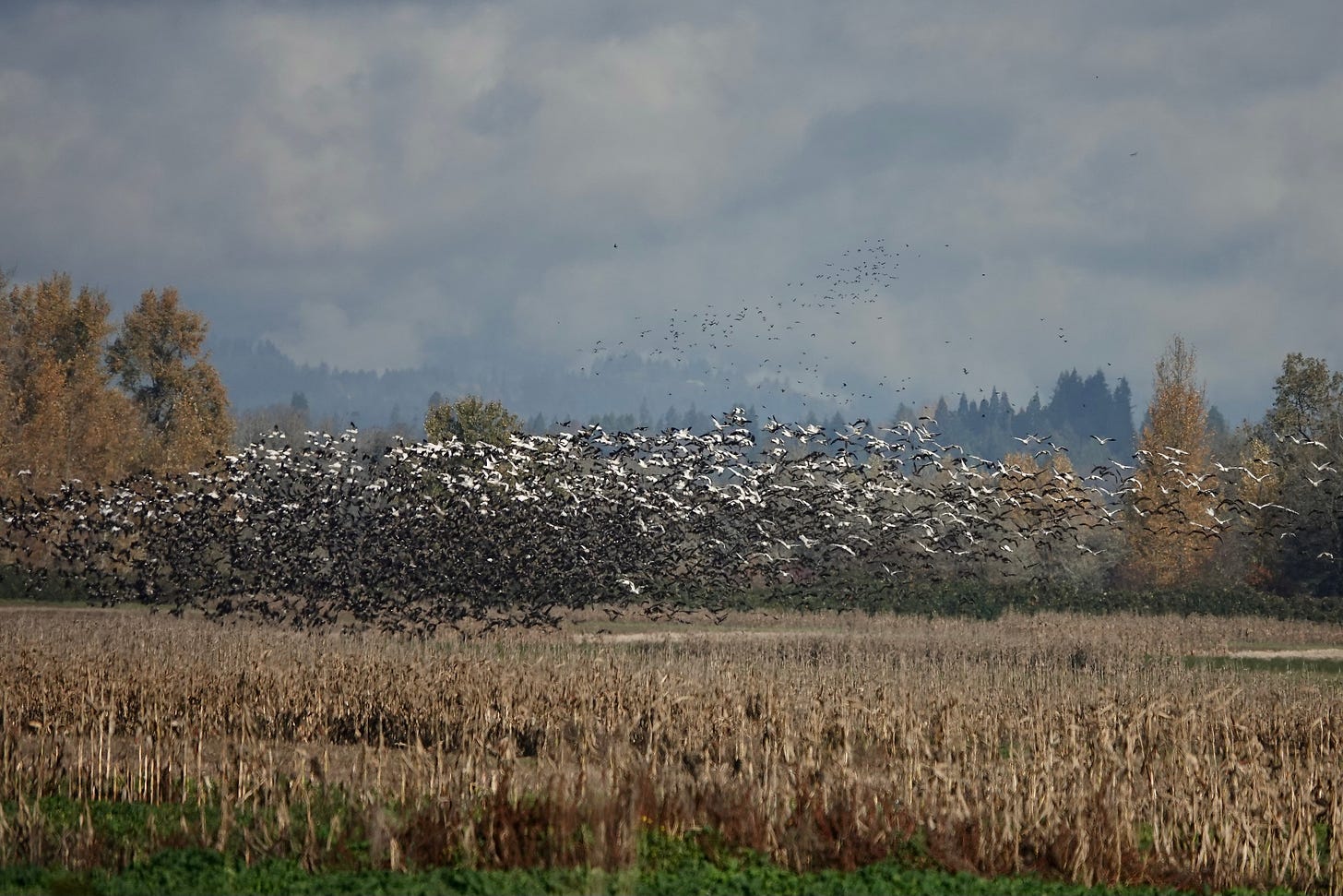
Vancouver Lake Lowlands and the greater region—including Sauvie Island and Ridgefield National Wildlife Refuge—is a magnificent kingdom of birds come wintertime! Snow Geese can number in the several thousand. Canada Geese and Cackling Geese as well. The impressive Tundra Swan, Trumpeter Swan and Sandhill Crane are not hard to come by in numbers. The largest Great Blue Heron and Great Egret rookeries on the Columbia are in the Vancouver Lake Lowlands and on Sauvie Island. And we haven’t even started on the ducks. All kinds of ducks! So, planes be damned, I had to at least try to get some decent field recordings.
Come winter I find myself craving the riotous, gorgeous, pandemonium of a huge number of geese taking to the air. You may not feel the same way, but I know I’m not alone. The sound, as calamitous as it is, actually has a very calming effect on me for some reason. Maybe it’s hard-wired into me. Humans have always listened for the presence of birds as an indicator of resources and a healthy ecosystem. I find the honking of geese to be reassuring. I hear: It’s okay. Don’t worry. Life is abundant!
And the call of the Sandhill Crane? Don’t get me started. It’s visceral. I feel connected to some vast timeline I can scarcely comprehend when I hear their rattling!
All this is to say: don’t go to Vancouver Lake Lowlands and think you’re going to have some pre-industrial nature experience, just you and the birds. Not gonna happen. What you hear on my Soundwalk is just the highlights. It’s magical realism.
But it piques curiosity about a time before planes, trains and automobiles, doesn’t it? If you could time travel, you might even be surprised by what you would have encountered here…
Vancouver Lake Lowlands History
What I found fascinating about this section of the Columbia River is how, for as much as it is a kingdom of birds, it has been the realm significant human habitation for longer than you might think. Author Jim Thayer paints a vivid picture of Native American society on the banks of the Columbia in the first chapter of a historical work in progress on his website foresthiker.com. It’s well worth a read if you’ve ever wondered what life in this part of the world was like prior to European contact.
Around 1750, no less than 16 Clackamas and Multnomah villages inhabited the “Wapato Valley”, a stretch of the lower Columbia River extending from the Gorge, down to Cowlitz River. It is estimated that prior to the first huge epidemics the Pacific Northwest was home to more than 300,000 Indians of which more than 40,000 people lived in the Wapato Valley – likely the highest population concentration in North America at that time. This population density of nearly 3.1 people per square miles was particularly remarkable given the fact that most of the population was located along the banks of the river and that this was a hunter-gather society that had no organized agriculture.
How was it possible to sustain that many people without any significant agricultural efforts? The answer lay in the remarkable fecundity of the Columbia River basin. It was home to elk, bear, deer, beaver, ducks, geese, sturgeon, salmon, smelt, wapato, camas onions, and a profusion of grass seeds and berries. It is estimated that historically, the Columbia River may have been the richest river in the world disgorging between 11 and 16 million salmon per year. And the Indians are estimated to have caught more than one fish in three!
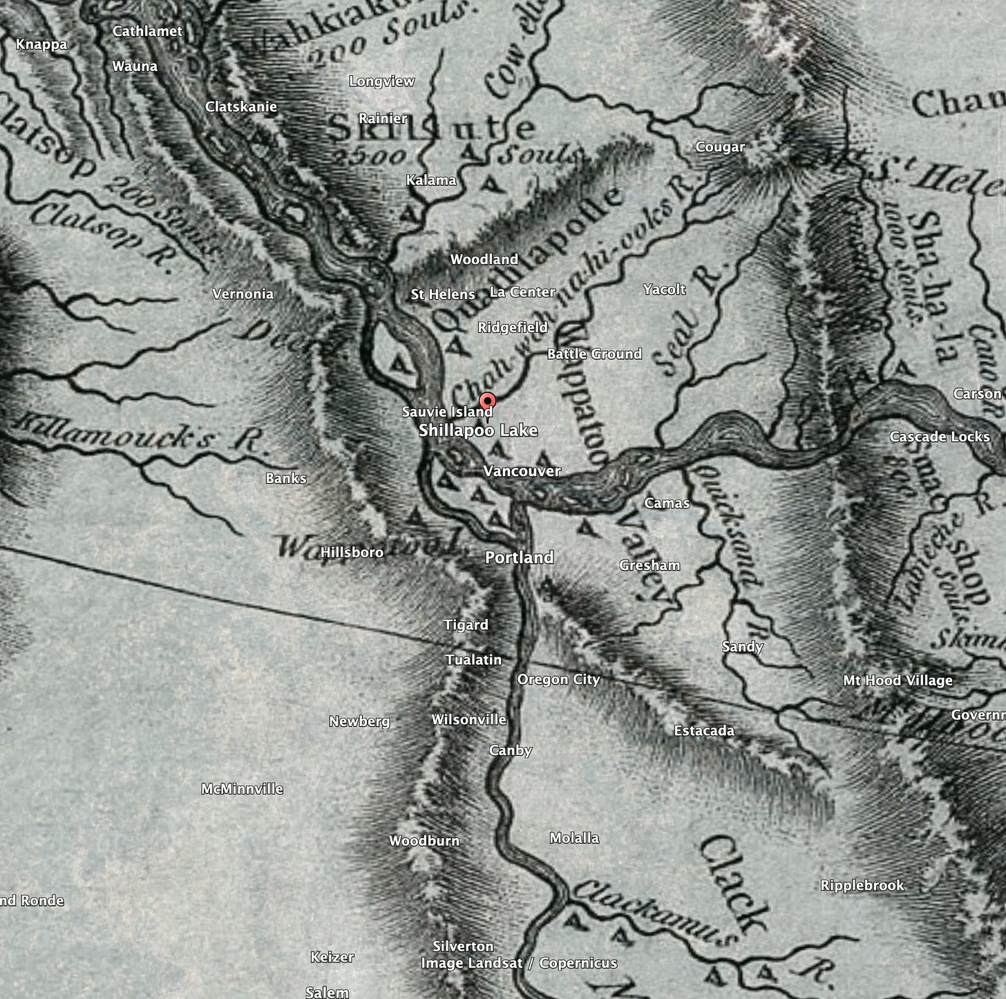
The mighty Columbia. The richest river in the world? No wonder this is still the kingdom of the birds, even though it is only a fraction as productive as it once was. Those of us who live in the vast watershed have heard a thing or two about this, certainly. We know the faustian bargain made with the river to extract electricity at the cost of Salmon. But fewer know how changed the watershed is in other ways:
Even the shoreline would have been unrecognizable to modern eyes. Gone were the well-defined riverbanks and instead we would have seen endless streams and inlets piercing the riverbanks and shallow bayou’s along the river’s edge where fish swam into the myriad inlets, streams and shallow ponds. Throughout this swampy landscape we would have seen the handiwork of the Indian fish trappers. The little streams would have been crisscrossed with wooden weirs, studded with strategically placed basket traps and wooden fishing platforms. The eastern shore of Sauvie Island had the recognizable beaches, but all along the length of the island small streams breached the shoreline feeding shallow channels that penetrated deep into the interior of the island. - Jim Thayer, foresthiker.com
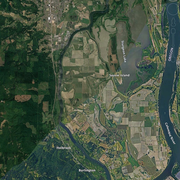
Our soundwalk takes us along the former shore of Shillapoo Lake, a 1000 acre lake drained in the 50’s for farmland.


Until quite recently Sauvie Island—just across the Columbia—once contained more water acres than land acres:

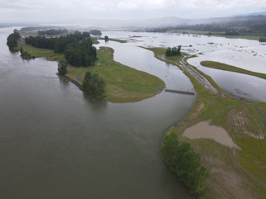
All along the banks of the Columbia were vast floodplains adding to matrix of abundance. In a rare reversal, twenty miles upriver at Steigerwald Lake National Wildlife Refuge, 1000 acres of floodplain were restored to the Columbia’s banks in 2021, after 60 years of being cut off by a levee.
“Millions of salmon that are out migrating through the Columbia River get to the estuary and they’re looking for floodplains like this. They have a much calmer environment and lower water velocity, so (the salmon) spend a lot less energy chasing food. There’s more food for them and there’s typically less predation risk.” - Chris Collins, program lead for the Lower Columbia Estuary Partnership, from Heavy rainfall tests Steigerwald’s newly reconnected floodplain
Of course, it’s no accident that The Hudson’s Bay Company established Fort Vancouver in 1825, in the midst of these lowlands to serve as the headquarters of the Company's interior fur trade. This was the most logical place to collect and transport furs to back to London; on the banks of a navigable river in the cradle of such abundant natural resources.
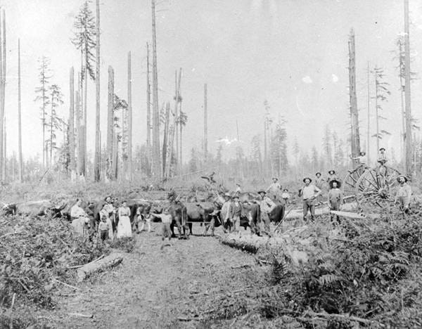
Company men quickly expanded farming and grazing operations in the following years. What they called Lower Plain, now Vancouver Lake Lowlands, was among the first areas of land cultivated by Europeans on “the frontier” simply because it did not need to be cleared of trees.
Fast forward to today where a power plant, a transfer station, a barge and rail interchange, and a sand & gravel company are all bordering the lowlands, within earshot. Fast forward to today where audio capture equipment is small and inexpensive, and where digital editing enables one to remove the industrial elements of the soundscape.
In some very small way I hope the escapist qualities of my soundwalks, which in part seek to transport the listener to a simpler time when human activity wasn’t the loudest part of the soundscape, can inspire connectivity and small actions toward restoring balance in our ways of being.

